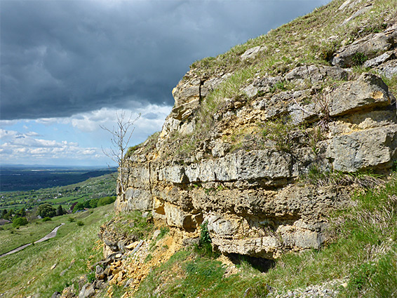
Large expanse of floral, calcareous grassland, including the highest point in the Cotswolds (Cleeve Hill), and bordered to the west by a line of colourful limestone cliffs
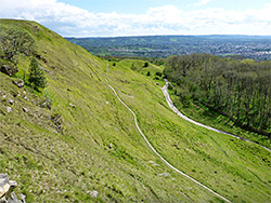
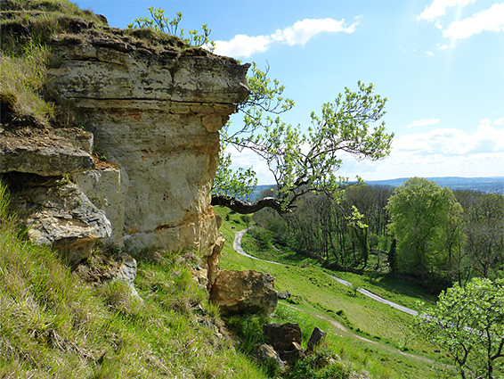
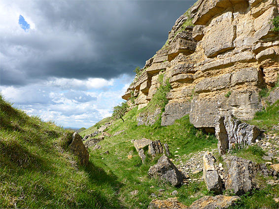
Cleeve Common, a Site of Special Scientific Interest, is the largest continuous expanse of calcareous grassland in the Cotswolds, extending for nearly 2 miles along the western edge of the escarpment, and including the highest point in Gloucestershire, 1,083 foot Cleeve Hill. The land slopes down steeply to the west, incorporating the most impressive line of cliffs anywhere in the Cotswolds, a band of grey-brown limestone up to 50 feet tall, while to the east the terrain is more gently undulating, as the flat land that comprises most of the common breaks up into a series of hollows and mounds.
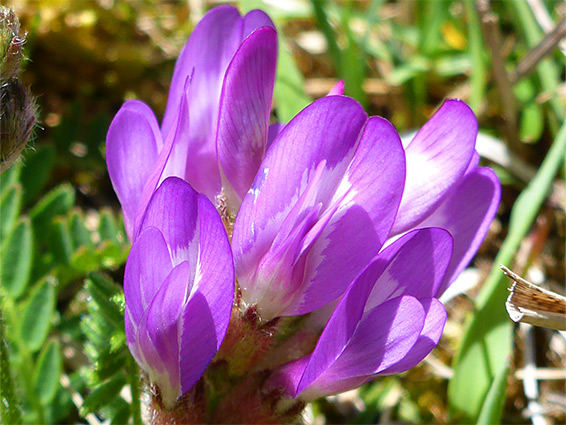
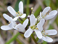
The common is important for its plant life, with rare species including frog orchid, musk orchid, purple milkvetch and red hemp-nettle, and also for its geology. The majority of this site has limestone bedrock, with just a few pockets of more acidic soils, the result of surface leaching or wind-blown deposits. The calcareous rocks are from the Birdlip Limestone Formation of the Inferior Oolite Group, exposed most noticeably in the western cliffs and also in various old quarries. The more uneven topography in the east is due to movement along pre-existing joints all.
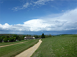
Cleeve Common is served by two large, free car parks along the north and south edges, and is crossed by many paths and tracks.
Several ancient earthworks can be seen on the common, though none are particularly distinctive; the main three structures, all Scheduled Monuments, are an Iron Age hillfort along the western rim of the escarpment (partly destroyed by quarrying), a ring settlement near the north entrance, probably Roman, and a dike running east to west for several hundred feet. There is also a stone block known as Huddlestone's Table, of uncertain age but undoubtedly ancient. Like much of the country, all the land was originally forested but had been largely cleared by the late Iron Age and has been used ever since as open pasture, mainly for grazing, less so for habitation. Quarrying began here in Roman times and continued until the 19th century.
The most used entrance to Cleeve Common is at the north edge, along a short road to Cleeve Hill Golf Club, off the B4632, parking below the walls of a disused quarry. Tracks from here head off in various directions, one to the southwest, below the cliffs, one just above them, another across the centre of the common and a fourth to the east, later curving to the south and running close to Postlip Warren, site of the uneven ground caused by faulting. Also near here are springs that sustain a small stream, running through a narrow corridor of marshy garassland. Two of the paths rejoin at the southern parking place, along a dead-end road to the Cleeve Common Masts, a set of communications towers. The rare wildflowers are not particularly widespread, instead concentrated in scattered areas including along embankments, on the verges of tracks and across the steeper, rockier terrain.