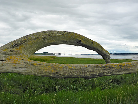
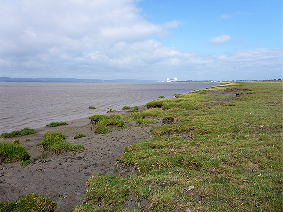
Littleton Pill and Oldbury Pill are two streams, meeting the Severn Estuary just beyond the little villages of Littleton-upon-Severn and Oldbury-on-Severn, and separated by a 1.3 mile band of saltmarsh, up to 500 feet across, usually used for cattle grazing; undeveloped, grassy scenery that extends upstream as far as the (decommissioned) Oldbury power station and south to the Severn Bridge (see Aust to Littleton Pill). The saltmarsh is bordered inland by an embankment, along or below which runs a path, starting in the south from the dead-end road to the coast at Littleton Pill, then in the north curving inland and following Oldbury Pill to the nearby village.
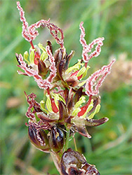
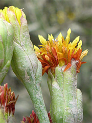
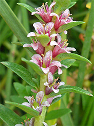
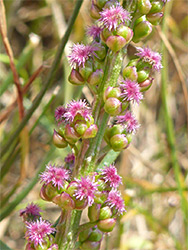
The path can be walked as a short there-and-back route, or as part of a longer hike from Aust or beyond, and while not particularly scenic close-up, this part of the Severn Estuary does have good, long-distance views, of the original Severn Bridge, and across to the Forest of Dean. The usual selection of saltmarsh plants grow here, best seen when flowering, in June and July; besides the common species, including greater and lesser sea-spurry, sea arrowgrass, sea aster and sea milkwort, this area is also home to the uncommon slender hare's ear, bupleurum tenuissimum, founded in scattered locations towards the lower edge of the saltmarsh.
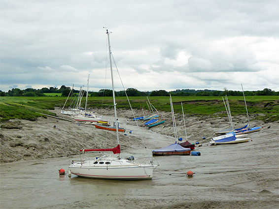
The end of the road from Littleton-upon-Severn has ample parking space, opposite the entrance to a small industrial estate, Whale Wharf, formerly site of the Littleton Brick Works. Paths start beyond a gate, one south towards Aust, the other over an earthen bridge across the pill and on towards Oldbury. Along here, the first section of the saltmarsh is mainly short grass, with not so much plant variety, then after 0.4 miles the land becomes a little rougher, with more varied vegetation, and also narrower, up to another tiny stream (Cowhill Pill), beyond which the grassland is now wider, leading to the much bigger inlet of Oldbury Pill, the lower end of which is used as a mooring for boats of the Thornbury Sailing Club. This wider section is known as Cowhill Warth; most is regular pasture, with the saltmarsh restricted to a fairly thin strip, beyond an embankment.