Narrow strips of calcareous grassland and woodland bordering the River Wye, spanning the England-Wales border, with many summer wildflowers, especially orchids
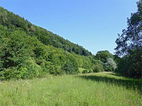
Dixon Embankment Nature Reserve is a small (3.5 acre) site, occupying part of a narrow strip of sloping land between the A40 and the River Wye, northeast of Monmouth. Historically a mix of woodland and farm fields, the land within the reserve was altered a few decades ago during widening of the highway to create a dual carriageway, forming an embankment immediately below the road, bordering a wider, flat area, now grassland, where earth was excavated to provide material for the road, and a remnant slope down to the river, since covered by scrub and trees. A small patch of the original woodland survives at the north end of the site, and in spring a population of wild daffodils are in bloom here. The reserve spans the border between Monmouthshire and Herefordshire, Wales and England, and is easily accessed directly from the highway.
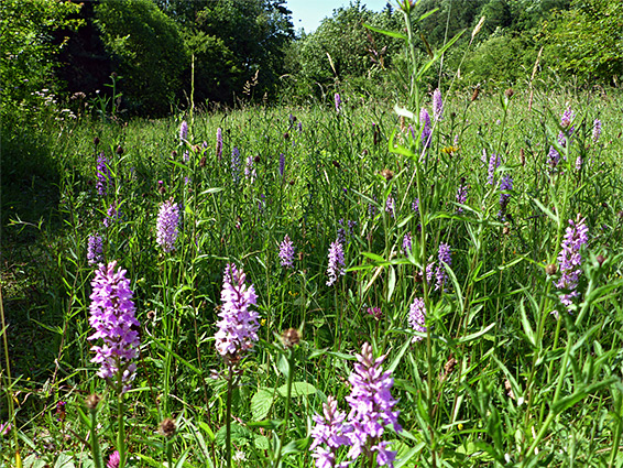
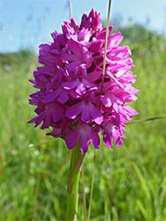
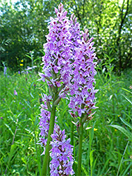
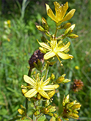
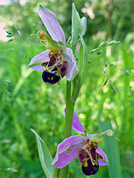
The grassland is the most notable component of the reserve since this has been colonised by a good range of limestone wildflowers, most numerous being orchids, and all of the three species found here (bee, common spotted, pyramidal) can produce hundreds of flowering stems, if conditions are right, though the bee orchid in particular can be almost absent in less favourable years. The reserve is also noted for butterflies and other insects, while adders and slow worms may sometimes be encountered.
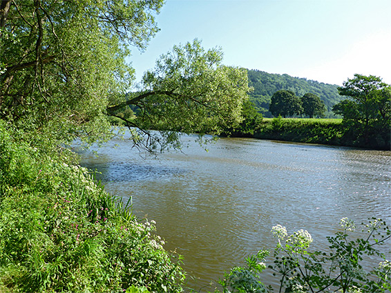
North of Monmouth, the A40 is a divided highway, the two dual lanes at slightly different elevations, separated by a strip of trees. The western lanes approximately follow the course of the original road, while the eastern carriageway is recently constructed. Dixon Embankment Nature Reserve, which is not signposted from the road, is 2 miles northeast of Monmouth and just north of a crossover bridge, which is closed to vehicles though still open to pedestrians, so north-bound drivers can park beside the blocked entrance, and walk over the bridge down to the reserve, while southbound traffic can park directly in front. The protected area extends northwards for about a thousand feet, with a patch of trees at the entrance, then the meadow, with the scrub-covered land to the east, sloping down to the river, and the embankment to the west, also covered by trees and bushes, enough to hide the traffic though not muffle its sound. There is no set path across the grassland though one does develop in summer, up one side and back down the other. Another path leads down a flight of steps to the main route alongside the river, the Wye Valley Walk. Prior to the road widening, the southernmost part of the reserve was occupied by an orchard and a building (Chapel Farm), but no trace of either remains.