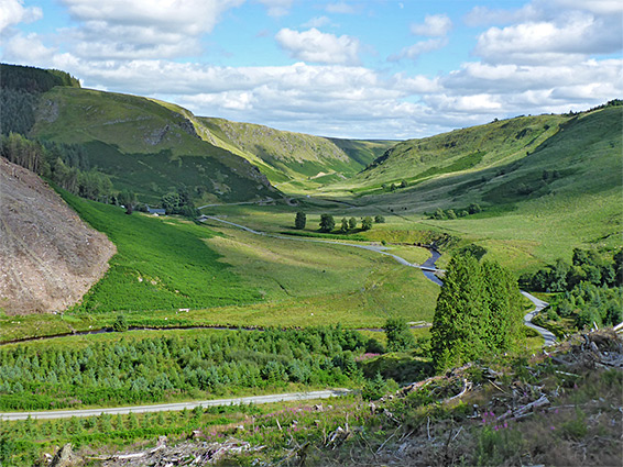
Remote valley in the Cambrian Mountains of central Wales, surrounded by moorland and woodland. Centred on a stream that flows partly through narrow, rock-lined channels
Management
Natural Resources Wales
Location
Along an unnamed road north of Abergwesyn; LD5 4TP
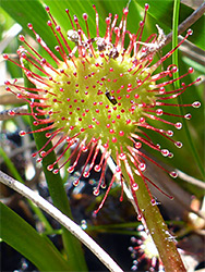
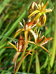
Nant Irfon is a river in the Cambrian Mountains of central Wales, about 20 miles in length, exiting the hills half way along its journey, at Llanwrtyd Wells, then meeting the River Wye at Builth Wells. The higher reaches flow through remote, steep-sided valleys, and one such stretch near the upper end is protected as Nant Irfon National Nature Reserve, a 2.8 mile section containing the river and the valley slopes to the west - sheltered terrain partly covered with ancient, high elevation oak woodland, the main reason for creation of the reserve, together with the many species of moss and lichen found here. Other environments include riparian land around the river itself, where such rare plants as bog asphodel, ivy-leaved bellflower and whorled caraway can be found.
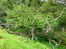
Historically, all of the valley was forested but now the oaks are reduced to a small area and, in the reverse of a natural landscape, the river corridor is largely free of trees, as are most of the valley sides, instead the hilltop plateau above is thickly wooded, all conifers, from plantations established in the mid 20th century. These are mostly on the west side of the valley, with a smaller area to the east.
The plantation though does not spoil the dramatic, empty and evocative appearance of the valley, which is entirely undeveloped; the only settlement nearby is the village of Abergwesyn, a short distance south.
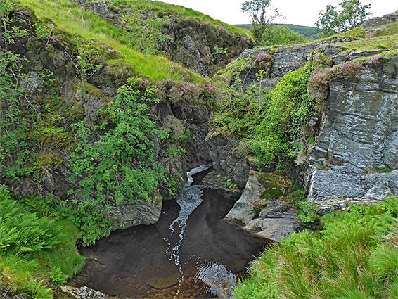
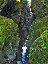
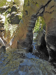
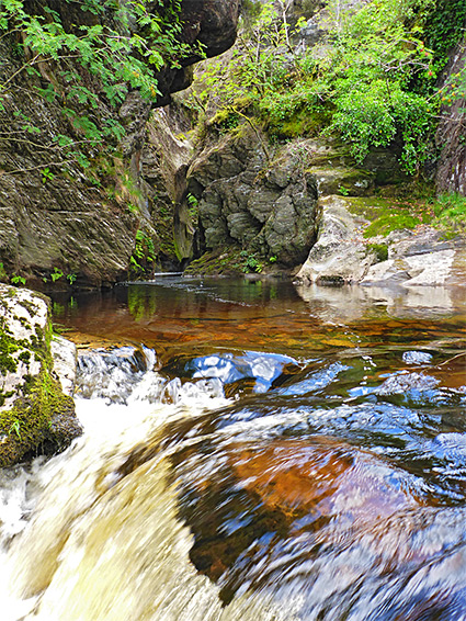
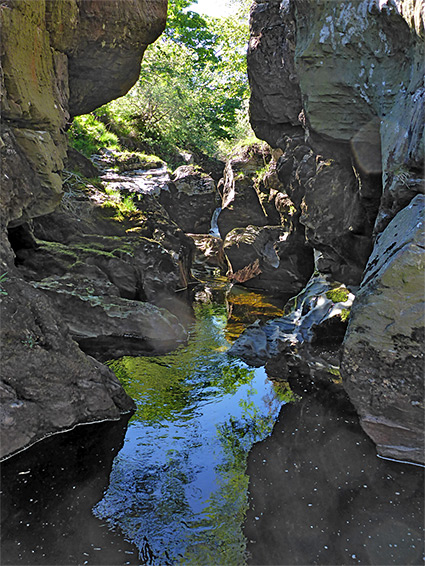
One other feature of note is a quarter-mile section of the river where the waters are contained within a narrow canyon - Camddwr Bleiddiad, or Wolves' Gorge, which may be traversed by wading or swimming; a fine example of a slot canyon, a rocky, vertical-walled ravine that is much deeper than it is wide.
The national nature reserve (NNR) is paralleled by an unnamed, little-travelled road north of Abergwesyn, which further north traverses the central area of the Cambrian Mountains, known as the Desert of Wales owing to its emptiness and lack of settlement. The road is generally around 300 feet east of the river and a little way above, with the reserve on the opposite side, and so reachable from the road only by crossing the river, which is fairly easy in many places, via stepping stones. There are just two official, signposted entrances, one at the north end, just west of a road bridge over the river, the other at the south end, where the preserve borders a (county) nature reserve, Vicarage Meadows - a gate along the north edge has a map and information board, at the start of a short northwards trail. This only penetrates a short distance into the NNR and later links with a track in the conifer plantation above, while the north entrance has no path at all - instead the place is explorable by cross-country walking, over the often rather steep slopes, which range in elevation from 880 feet to 1,550 feet.
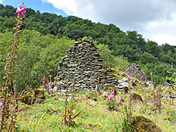
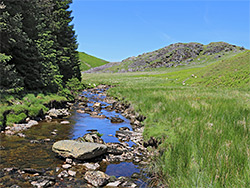
Land at the south end of the reserve, adjoining Vicarage Meadows, is partly wooded, otherwise covered by long grass, and it slopes fairly gently. The terrain incudes various boggy patches, especially around a tributary stream (Hen Nant), good for such plants as heath spotted orchid and bog asphodel. Just beyond are the stone ruins of Digyff, an ancient farmhouse. Further north, the land is steeper, sprinkled with rocky outcrops, and also less wooded. The river below is fairly unremarkable at this stage; unenclosed, flowing over just a few little cascades, but becomes confined at the entrance to the gorge, at the point where the underlying rocks change from Caerau Mudstone to the harder Rhayader Mudstone, causing the river to erode more downwards than sideways. Upstream, the gorge ends where the rocks change back to the Caerau strata, and once more the river is shallow and open, for another 0.6 miles, to the north end of the reserve, where the road leaves the valley floor and climbs through the conifer plantation, to the plateau above to the west. Further upstream, the river, now directly bordered to the west by the conifers, flows through another short rocky section with a few cascades and confined channels, then winds across treeless moorland, past a rocky summit (Careg yr Adar), and over lower relief land of hills and grassy flats.
The upper end of the Camddwr Bleiddiad gorge starts with a cascade over boulders and exposed strata, through some little cascades and a tiny arch, into a dark passage below overhanging cliffs, dark grey or covered by green moss. Several sections beyond require swimming to explore fully. About two thirds through the narrows is a briefly open part, accessible from either east or west by walking down the slopes; upstream is a big pool, gradually deepening and narrowing, while in the other direction are more enclosed passageways, ending in a shallow slot emptying into another big pool. The total length of the gorge is 1,600 feet and at least an hour could be spent exploring, either slowly progressing all the way through at stream level, or climbing up and down at various points to see the more accessible sections.