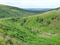
The valley of the Nant Menasgin, initially wooded, then open at higher elevations, where it divides, into Cwm Oergwm and Cwm Cwareli. The stream forms waterfalls and pools, and can be followed either along paths or by walking beside the water
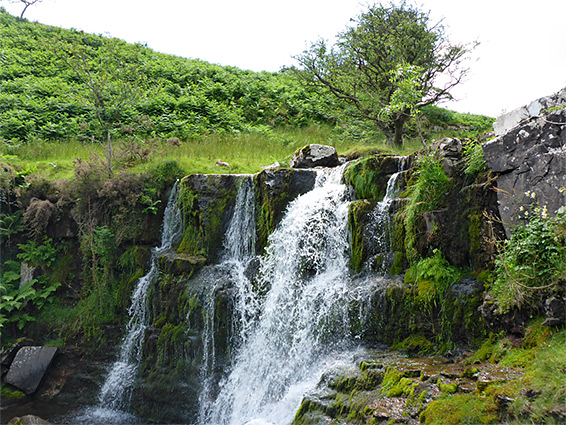
The Nant Menasgin is one of four streams that flow northwards below the Pen y Fan - Fan y Big plateau at the centre of the Brecon Beacons, the others, to the west, being Nant Cwm Llwch, Nant Serre and Nant Cynwyn. Like all, the lower reaches of the Nant Menasgin flow through a wooded ravine forming waterfalls, cascades and pools, while the upper section crosses open slopes to its source beneath the cliffs of the plateau. The stream divides at the upper edge of the trees, the two branches within valleys named Cwm Oergwm and Cwm Cwareli; the former contains several larger, more photogenic waterfalls, and the latter although more enclosed, is rather less interesting.
Tracks, then paths, follow the stream either side of the wooded section, generally staying around 100 feet above the stream, out-of-sight of the water, then fade away once into open moorland, though as usual for this area, the treeless, grassy slopes allow for relatively easy cross-country walking, in any direction. The southerly of the two tracks starts at a footbridge over the stream and stays closer to the valley floor so is the preferred route; this begins near the end of the minor road to Pentwyn farm, where parking is very limited, so the hike is best started another 1.3 miles downstream at the village of Llanfrynach, giving an overall distance, to the head of the valley, of about 4 miles. The hike can extended by climbing up to the summit plateau, while another option is to the follow the actual stream through the wooded section, alongside its rarely seen falls and pools, which are made more picturesque by the red colour of the sedimentary bedrock.
The walk described below is along the path from Llanfrynach to the footbridge, then all beside the stream, through the woods and along Cwm Oergwm, up to the summit plateau then down a ridge towards Cwm Cwareli and along the south-side track back to the footbridge and finally retracing steps to Llanfrynach - a partial loop of 9 miles.
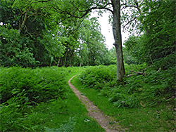
Vehicles may be parked along the main street through Llanfrynach, near the church. The path (part of the long-distance Three Rivers Ride) starts just west of town, crossing a field then entering the wooded corridor enclosing the Nant Menasgin, here flowing over nearly level ground. The path runs through a few meadows, then leaves the vicinity of the stream, climbs slightly across another patch of woods, traverses four more fields and meets the dead-end road to Pentwyn farm; just before the entrance is an old stony track that descends a short distance back to the stream, crossing on a footbridge, at a point just below the start of the most enclosed section of the drainage, extending south for about a mile. The less confined downstream stretch has a few minor falls and can also quite easily be followed, 0.4 miles to the point where the path reappears.
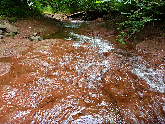
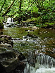
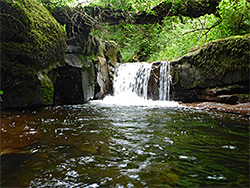
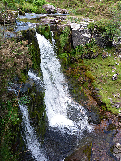
Upstream of the footbridge the Nant Menasgin flows through a little narrow channel and is then wider, enclosed by steep, overgrown, pathless slopes with many boulders and logs in the creekbed. Walking is generally easiest right beside the river, sometimes rising a little way to pass obstacles. There is in general no need for any wading, just crossing the stream in some places using stepping stones. Most of the bedrock is dull red in colour, mudstone from the St Maughans Formation, often exposed in terraces and benches. The largest waterfall in this wooded section is about 5 feet, tumbling into a deep, rock-lined pool, passed by a bench on the west side; beyond are more cascades and pools, as the valley sides gradually become less tall, the trees smaller and more scattered, up to a fence marking the lower edge of the moorland, and the approximate upper end of the woods, after which walking becomes more straightforward.
Upper Section of Nant Menasgin to the Summit Plateau
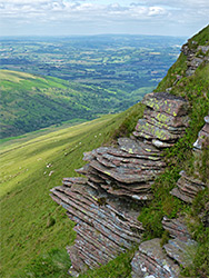
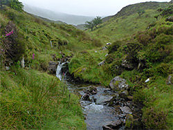
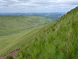
The upper section of the Nant Menasgin (Cwm Oergwm), beyond the wooded corridor, includes four main waterfalls, up to 20 feet tall, and many smaller cascades, and may be followed without difficulty, by walking along the grassy banks on either side of the drainage. As it approaches the foot of the tall cliffs at the head of the valley, below Fan y Big, the stream divides into a number of small tributaries, and the ground steadily steepens. If climbing to the summit plateau, one possible route is via a minor drainage to the southeast, about halfway along the cliffs of Craig Cwareli; this involves a climb of around 800 feet, meeting a well-used path on the plateau above. This runs northwards, right along the rim, then bends to the east after 0.3 miles, at which point a lesser, unofficial trail forks off due north, descending the sloping ridge that divides Cwm Oergwm from Cwm Cwareli. All this elevated section has spectacular views in all directions, including west to Pen y Fan and north over many miles of central Wales.
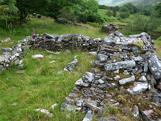
The faint path stays on the sloping ridgeline, descending all the while, veering west a little and meeting a wider path close to Cwm Oergwm, which leads all the way back to the footbridge near Pentwyn farm. This trail leaves the open moorland, beyond a boundary wall, and soon after crosses the stream from the lower end of Cwm Cwareli, followed by three smaller streams in quick succession, the latter beside a ruined stone building. Just beyond is the gate and a hut as the path widens to a track, now bordered by woodland to the west, above the enclosed section of the Nant Menasgin. The track eventually becomes a paved road and could followed all the way to Llanfrynach, but an alternative way back is via a short path that leads down to the footbridge near Pentwyn farm, after which the initial route can be retraced.