Loop hike to four summits in the Brecon Beacons, including the two highest points (Corn Du and Pen y Fan); spectacular views of ridges and valleys. Several trailheads and route options
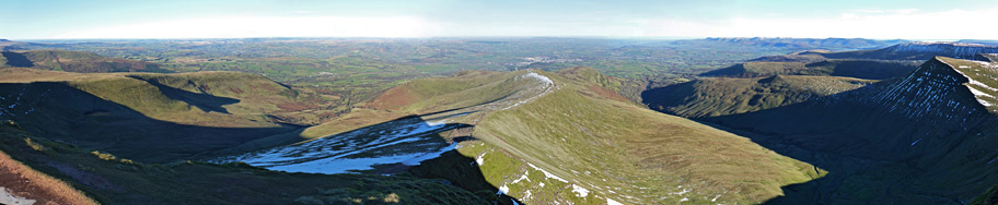
Brecon Beacons National Park contains three main groups of peaks - the Black Mountain area in the west, the Brecon Beacons themselves at the centre, and the slightly lower Black Mountains to the east, together forming a continuous high elevation region of over 40 miles west to east and up to 20 miles north to south. The two most scenic areas are the remote Black Mountain plateau, and the central area of the Brecon Beacons, which includes the two highest peaks in the park, 2,864 foot Corn Du and 2,907 foot Pen y Fan.
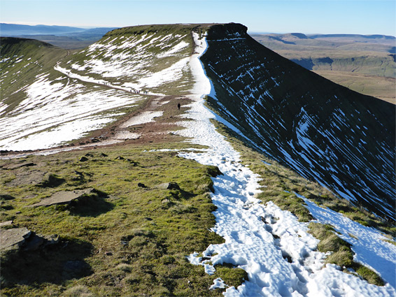
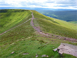
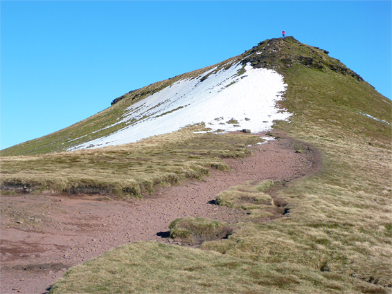
Unlike the Black Mountain plateau, much of which is far from any road and hence lightly visited, Pen y Fan and its surrounding peaks are often very busy, especially along the principal summit route, a wide path that approaches from the southwest, gaining 1,500 feet over 2 miles - somewhat strenuous but still a relatively easy way to reach the highest point in the south of the UK, south of Snowdonia. The peak forms part of a horseshoe-shaped ridge containing several other summits, curving around the scenic upper end of the glacier-carved valley of the Taf Fechan river, and which is crossed by many paths; to summits, along other valleys to the north and south, and across the slopes, so there are plenty of choices for long and short hikes, loops or there-and-back walks.
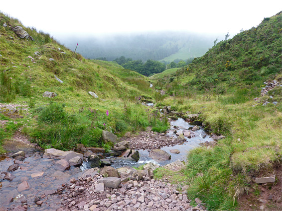
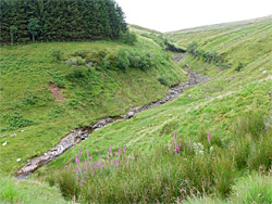
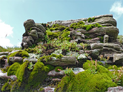
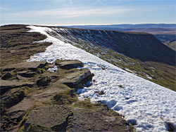
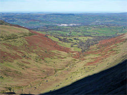
Like most of the Brecon Beacons, the hills are covered only by short grass with occasional rocky outcrops, so there is nothing to block the long distance views; north across the valleys and the farmland of central Wales, and south towards the Bristol Channel. Besides the many hikers, the peaks are also used daily by the military, as the short but steep climbs are ideal for training walks. The Taf Fechan valley contains two reservoirs and several areas of woodland, while some of the streams that drain the peaks form little waterfalls, but for the most part the attractions of this area are the high peaks, the open ridges and the dramatic views.
By far the most used access point to the central Brecon Beacons is the Pont ar Daf trailhead along the A470, between the Storey Arms activity centre and the north end of Beacons Reservoir, ten miles north of Merthyr Tydfil, and the usual hike is the 4 mile round trip to Corn Du and Pen y Fan, taking from two hours or more. The trail crosses a small stream (Blaen Taf Fawr) flowing down a V-shaped ravine then climbs at a fairly constant gradient, heading northwest to a pass just south of the lower peak, where it meets the ridgeline path; both summits are then a short walk north. This section of the path forms part of the long-distance Beacons Way, which continues eastwards along the ridgeline to the neighbouring peaks of Cribyn and Fan y Big. Another trail accesses Corn Du directly from the Storey Arms, allowing a loop hike (to Pen y Fan) of 4.6 miles.
All the summits may also be reached from the north via seven other trails, starting along minor roads south of the River Usk, but these are not much used; instead, the second main access point to the central peaks is from the south, either along a dead-end road close to the Taf Fechan river, or a short distance east along a through road at Blaen-y-Glyn, at the head of the adjoining valley of the Caerfanell River, which contains many waterfalls. The former is used for shorter loops to the four main peaks of Corn Du, Pen y Fan, Cribyn and Fan y Big, while the latter is preferred for longer hikes taking in additional, lesser summits further east. There are several route options from each trailhead.
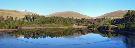
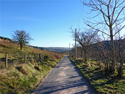
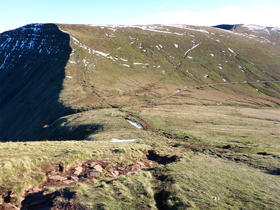
The most used of the two southern access points is the Taf Fechan car park, managed by the Forestry Commission, beside the road to the two Neuadd reservoirs, at the upper end of the valley. This road is narrow, lightly travelled, and scenic, earlier passing two other reservoirs (Pontsticill and Pentwyn), and the river, which forms some waterfalls and cascades. From the parking area the first 0.6 miles of the hike is along the road, which passes a couple of junctions and ends in front of a disused pumping station next to the lower reservoir; an aged brick building that still contains all the original pumping equipment though is fenced off to stop people entering. Army vehicles are often parked at the end of the road, and there are a few other spaces on verges, but the forest carpark is the usual place to start. Several groves of pine trees grow in this part of the valley, level with the north end of the Taf Fechan Forest, but ahead, the far upper end of the valley is treeless, and the various peaks are now in view, a couple of miles away. The hike continues westwards along a path that descends slightly, crosses the river and the dam forming the reservoir, which reflects the distant summit of Pen y Fan, then leads through a gate and steeply up the side of the valley, gaining 750 feet (230 metres), to the edge of a broad, gently sloping plateau, the near side of which ends in an abrupt escarpment named Graig Fan Ddu. Slightly higher ground still blocks the land to the west, but to the east all the Taf Fechan valley is in full view, and south towards Pentwyn Reservoir. Turning right, the path proceeds north along the edge of the plateau, which narrows and leads to a ridge that does eventually allow good views westwards, down the valley of Cwm Crew and beyond towards the slightly lower elevation hills of the Fforest Fawr region.
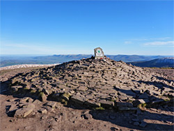
The path rises slightly along a ridge (Craig Gwaun Taf) to a minor summit, then descends to a major four-way junction; left is the busy path down to Pont ar Daf on the A470, the main approach to Pen y Fan, and right is the most direct route to this peak, while straight ahead is the trail to the adjacent summit of Corn Du, 190 feet above the junction. From this peak a path continues along the ridge and soon rejoins the other route, which continues with a short ascent to the highest mountain in the Beacons. The summit of Pen y Fan is nearly flat for about 200 feet so there is plenty of space for the several dozen people that may be here at popular times. To the north are two broad valleys - Cwm Llwch, which contains a small lake, and Cwm Sere, both sloping steeply and merging in a relatively short distance with fields and woodland around the River Usk, this point being close to the north edge of the mountains.
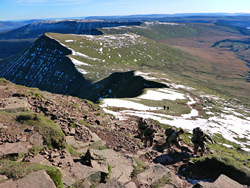
A less-used path heads due north from Pen y Fan along the ridge between the two valleys, but the main continuation route is east, down a ridge named Craig Cwm Sere (a rocky section of the path, known as Jacob's Ladder) to a saddle and steeply up again to the next peak, 2,608 foot Cribyn. As with Corn Du there is a bypass route, crossing the slopes to the south while staying fairly level, on to the next saddle. The summit of Cribyn gives perhaps the best views of Pen y Fan and its very steep northeast face, as well as of the valleys to the north. From here the eastwards path has a longer, less steep descent along Craig Cwm Cynwyn to another saddle, at which point an old vehicle track leads due south and meets the road to the Neuadd reservoirs, forming a loop of 7.8 miles. In the other direction the track continues down the next valley, Cwm Cynwyn, and was once the main road through this part of the mountains, used by horses and carriages; the Romans are believed to have first established the route. Another hike option, for an only slightly longer loop, is to continue east; a short climb to the next summit, Fan y Big, between the valleys of Cwm Cynwyn and Cwm Oergwm, followed by a nearly level walk southwards along the ridgeline (Craig Cwmoergwm) until this starts to curve to the east, and finally a diagonal traverse of the slopes below, back to the old road. This makes a round trip of 8.3 miles.
There are several options for even longer loops, incorporating more land to the east. One is along a trail that stays on the ridgeline that forms the north edge of the mountains; this curves back north, rising gently to the narrow promontory of Bwich y Ddwyallt then curves abruptly back south and later meets the other, cut-off trail, which is the most used route. Ahead the path divides again, one branch descending the valley to the west, back towards the Lower Neuadd Reservoir pumphouse, the other climbing slightly along the last section of the horseshoe ridge (Craig y Fan Ddu) and finally down to the alternative parking area at Blaen-y-Glyn. The last section runs alongside the edge of woodland and follows a stream that forms a few small waterfalls. The Taf Fechan parking is then 1.6 miles away, initially along the paved road and then a forest track. The longest of these loops is 12 miles.