Up to 20 waterfalls of varying sizes and shapes, in wooded gorges along the upper section of the Caerfanell River, and its tributary Nant Bwrefwr, most of which are easily viewed from the adjacent paths
Although concentrated in Waterfall Country, in the vicinity of Pontneddfechan, there are plenty of falls and cascades in other parts of Brecon Beacons National Park, such as along the upper reaches of the Caerfanell River, and its tributary Nant Bwrefwr. The river flows for ten miles, starting on the high plateau of Gwaun Cerrig Llwydion, east of Fan y Big, then flowing through a grassy, U-shaped valley and into more forested terrain where most of the falls are located, before becoming impounded to form Talybont Reservoir and eventually joining the River Usk at the village of Llansantffraed.
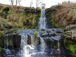
Around 20 significant waterfalls are found over a two mile stretch of the river, and a half mile of the Nant Bwrefwr, of which only one has an official name, Blaen y Glyn, or Caerfanell Falls, while another, near the upper end of the river, is informally known as Torpantau Falls. Most of the cascades are quite easily accessed, starting from either of two parking areas along the approach road, between Talybont-on-Usk and Pontsticill; the uppermost is beside the Nant Bwrefwr about halfway along its waterfall section, while the lower overlooks the Caerfanell River, just downstream of its lowest falls.
The two parking areas are linked by a path which continues alongside the upper section of Nant Bwrefwr then climbs a steep ridge to the plateau of Craig y Fan Ddu, and later passes the very upper end of the Caerfanell River, along the way to Gwaun Cerrig Llwydion. Another path leads directly along the river, close to most of its falls, then heads off to another big plateau, Waun Rydd, on the far (east) side of the valley, and connects with the route from Gwaun Cerrig Llwydion to form a five mile loop, of which just over one mile is past the streams and the remainder is over open ground. For people just interested in the waterfalls, most can be seen by a partly there-and-back hike of about three miles, starting from the lower parking area, or, the hike described below, by a loop of four miles that includes an off-trail section incorporating the uppermost falls (Torpantau). The ground around here is very steep so care is needed when descending.
The upper of the two Blaen y Glyn parking areas is the largest and most used, since it connects with several long-distance routes, to Pen y Fan and other popular peaks. The lower area is in general preferred if visiting the falls, since the main one is closer, and reached with less elevation change, though for the loop hike, both start points are equally suitable.
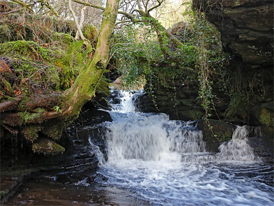
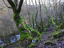
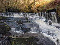
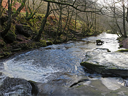
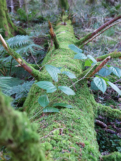
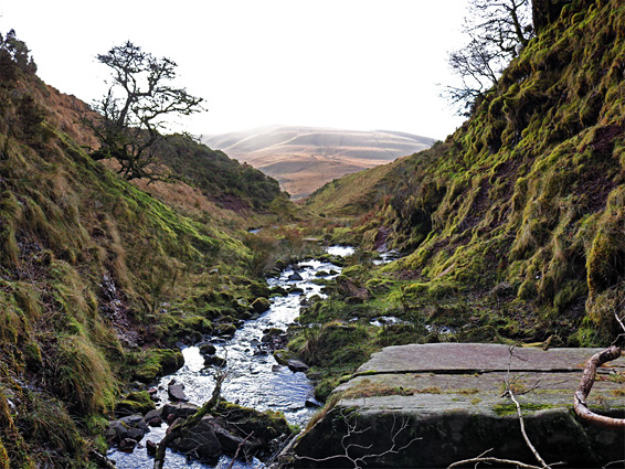
The lower parking area, signed simply 'Waterfalls' is set back a short distance in the woods on the north side of the road, just west of the bridge over the Caerfanell River, a point 5 miles from Pontsticill and 5.5 miles from Talybont-on-Usk. The path climbs a little through dark forest, past ground covered with fallen branches and thick moss, staying about 50 feet above the river. The first significant cascade soon comes into view below, as the river flows over a low stone dam, forming a shallow weir. Just beyond is a briefly narrow part, where the river is constricted between two rocks to create quite a forceful torrent, spreading out below over flat terraces, very slippery at the edges. The valley becomes somewhat shallower and more open above, before the next waterfall, which has two stages, the upper somewhat elongated, forming a whitewater curtain in times of high flow. Slightly further, the path comes to a junction, a quarter of a mile from the start, beside the confluence with Nant Bwrefwr. The main falls in the area, Blaen y Glyn, are visible ahead and could be visited now, or left for the return part of the loop.
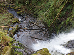
The other path at the junction, on the left (west), leads to the upper parking area, also a quarter of a mile away, and 300 feet higher. The lowest waterfall along Nant Bwrefwr is about 20 feet high, and the waters flow between two small cliffs covered in particularly bright green moss, a feature easily viewed from the trail. The path then moves away from the stream, climbing a ridge between it and a lesser tributary to the north, so the other falls require walking a little way off-trail to see properly. There are two main drops, one into an enclosed bowl that often contains piles of fallen tree trunks, the other a taller feature down more very mossy cliffs. Above here is one smaller set of cascades, just below the upper parking area.
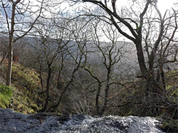
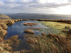
The main path at the upper parking area follows Nant Bwrefwr further upstream, again staying somewhat out of sight of the waters, which flow through some short, V-shaped passages, quite enclosed, between mossy walls and lines of trees, forming some trickling cascades and pretty pools. A little way above, the creek flows over a rather bigger fall, of around 50 feet, then beyond here the ground is more open, with very few trees. There is one final cascade before the terrain becomes fairly level, and the stream moves way to the northwest, while the path continues due north, ascending the ridge towards the Craig y Fan Ddu plateau, rising another 500 feet. The trail follows the east edge of the escarpment, giving grand views of the upper Caerfanell valley, and after another 0.7 miles reaches the river itself, here just a tiny stream flowing gently over the flat land to the west before tumbling down the steep east face of the scarp.
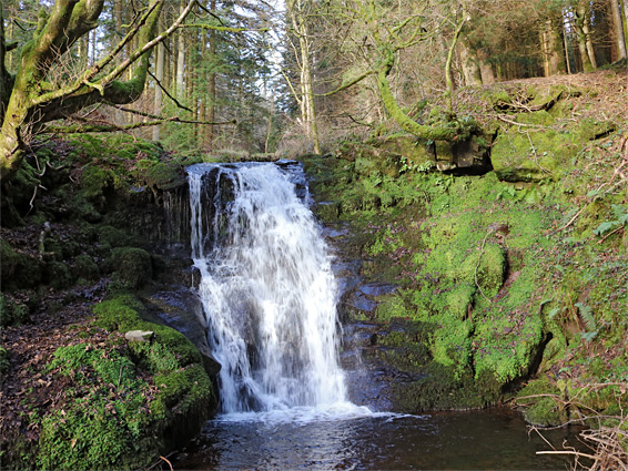
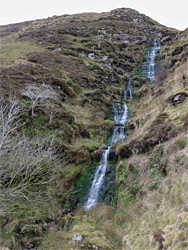
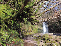
The easiest route down seems to be on the north side, traversing to the river if desired to see the various stages of Torpantau Falls, which is an elongated drop formed of several sections, large and small. After descending 600 feet down the slippy, grassy slopes, the ground becomes much less steep and the river flows unremarkably over grassland for half a mile, past the tributary of Blaen y Glyn (where the trail from Waun Rydd comes into view), until it starts to form a shallow gorge, and the trees return. The next section has perhaps four significant falls, none particularly spectacular, before the main waterfall in the area, Caerfanell Falls (or Blaen y Glyn); this is about 30 feet tall, dropping into a short, moderately enclosed gorge where the water flows over a mix of boulders and flat, slippery rocks. The path, which is on the east side of the river, crosses to the west via a footbridge and then reaches a junction, with the two routes to the upper and lower parking areas.