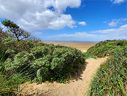
Broad band of grassy and sandy dunes stretching over 2 miles along the west Somerset coast, partly occupied by a golf course and partly by a local nature reserve. Beyond is a wide sandy beach, busy towards the north, much quieter to the south
The Berrow Dunes occupy nearly half of the six mile long stretch of flat, sandy terrain along the west Somerset coast between Brean Down and Burnham-on-Sea beside the mouth of the River Parrett, stretching up to a quarter of a mile inland.
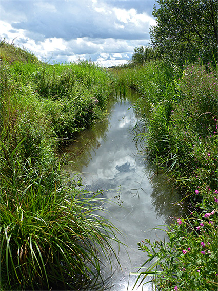
A sizeable portion is occupied by the Burnham and Berrow Golf Course, which is crossed by several public rights-of-way, while the majority of the remainder is contained within the Berrow Dunes Local Nature Reserve, part of a Site of Special Scientific Interest (SSSI) that covers all of the sands, and was created an account of the varied habitats, including sand, saltmarsh, slacks, ponds, scrub, woodland and a freshwater lagoon, and the consequently high number of plant species.
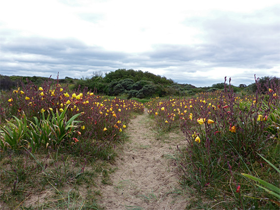
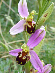
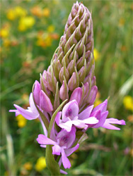
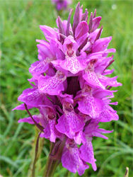
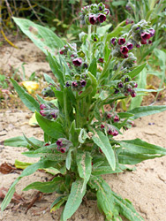
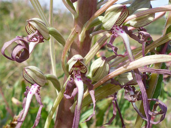
Over 270 plants have been recorded in the dunes, many relatively rare. The most notable plant is probably the lizard orchid, himantoglossum hircinum - the tallest orchid in the UK, up to one metre, and apart from here and a few other tiny, scattered locations, found only in Kent. Other orchids include bee, common spotted, early marsh, pyramidal and southern marsh.
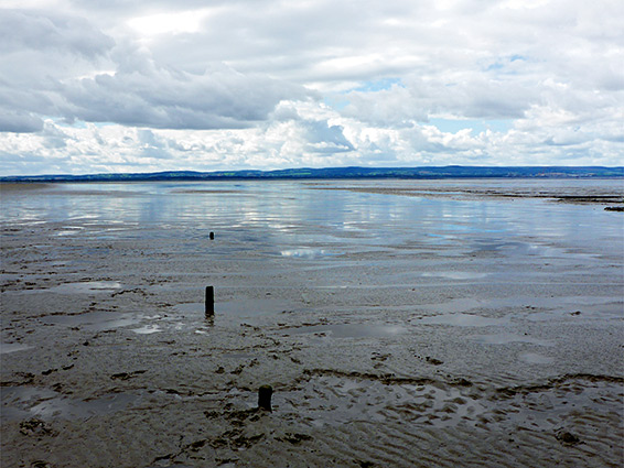
The plants provide one reason to visit, and the dunes are quite scenic; even though the golf course occupies much of the area there are still plenty of quiet, little-visited places, especially along the southern reaches of the strip of land separating the course from the coast. But most people are here for either dog walking for the usual beach activities, since along the shoreline all the dunes are bordered by a wide belt of sand either side of the high water mark; sometimes busy towards the north, near the vehicular access point, but usually empty to the south. At low tide the sand gives way to a vast expanse of mud extending up to 4 miles out to sea, the Berrow Flats.
The Berrow Dunes extend for 2.2 miles north to south, all part of the SSSI. The golf course occupies the southern 1.7 miles, the next 0.4 miles is the local nature reserve while the northernmost tip is regular land. Two paths lead from the coast road to the beach at either end of the golf course, two more cross towards the middle, and there are two further paths through the nature reserve and one more just beyond. The beach access road is along the north edge of the dunes, and parking along here, or on the sands, is charged at Ł6 per vehicle. Parking is free for the nature reserve, as it is in other places along the main road such as in front of St Mary's Church, near one of the two paths across the middle of the golf course. Also near the church, just to the southeast, is a short grass meadow good for orchids in early summer.
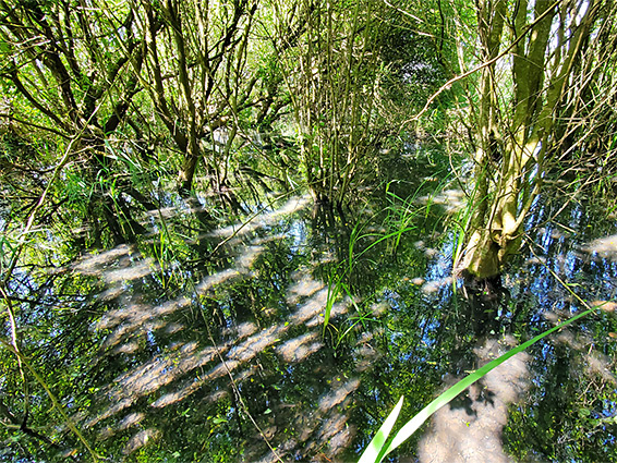
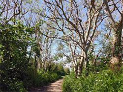
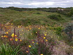
The main path into the nature reserve, starting from the parking area along Coast Road, first passes through a bushy area where wildflowers are limited to common, weedy species - all the more interesting plants are in the western third, as here the land is mostly covered by short grass albeit with encroaching bushes, growing on the fixed dunes, between which are some of the slacks - flat depressions where the moisture content is higher, leading to more varied plants. In recent years the water table seems to have lowered, however. The western boundary of the reserve, beyond another strip of trees and bushes, is formed by the foredunes, mostly pure sand but still with some plants of interest such as sea rocket, Portland spurge and miner's lettuce. There are also several ponds in the reserve, all marked on the map at the entrance, and enough features to spend at least an hour exploring, looking for plants and wildlife.
Public access to the golf course is limited to the four paths from Coast Road to the beach, and another path that runs most of the way along the east edge. Between the course and the Bristol Channel is a belt of scrub, grassland and marshy land up to 300 feet wide, parts of which is traversed by a north-south trail though most is rather inaccessible due to the undergrowth. Within the golf course are a number of undeveloped dunes up to 30 feet high and they also have many plants including the lizard orchids - one location is a sandy ridge southwest of the 15th tee, reached by the public path along the east edge of the course.
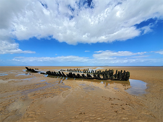
Like all beaches along this part of the Somerset coast, the section closest to the shore is sandy, a uniform band around 200 feet across, then beyond all is mud. Vehicles have access to half a mile of the sands, from the access point at the north end as far as a wooden fence; the coastline is much less busy for the 2 miles beyond this due to the limited inland access. The beach looks the same all the way along, with just one feature of note, 1,000 feet from the edge of the dunes and revealed only at low tide. This is the wreck of the SS Nornen, a wooden barque from Norway which became grounded in a storm in March 1897, and proved impossible to salvage. Two stark rows of broken timbers are all that remains.