The highest summit of the Mendip Hills, at the centre of a sizable area of moorland, and a narrow, winding, cliff-lined valley concealing several caves
Location
Burrington, Somerset; parking for the hike is along the B3134; BS40 7AU
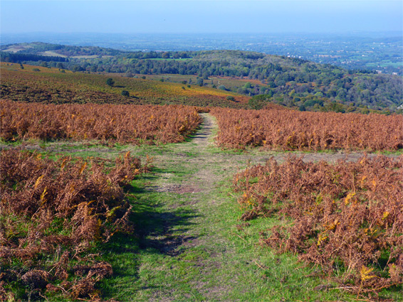
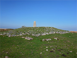
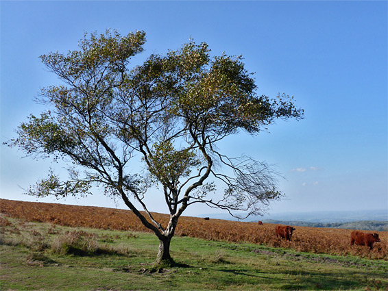
At 1,066 feet (325 metres) Black Down is the highest summit in the Mendip Hills of north Somerset, and lies at the centre of the largest area of open, unfenced moorland in the county. The actual high point is not very prominent since the top of the peak forms a broad ridge nearly one mile along, oriented east to west, along the north edge of the hills - to the south, the land is only slightly lower hence the views are not so dramatic, but in the opposite direction the land slopes steeply down to the wide, flat, agricultural lands of Chew Valley, with the Bristol Channel visible beyond. The upper reaches of Black Down are almost completely treeless, covered only by short grass and dense bracken, the latter kept in check by grazing, of Exmoor ponies and Devon red cattle.
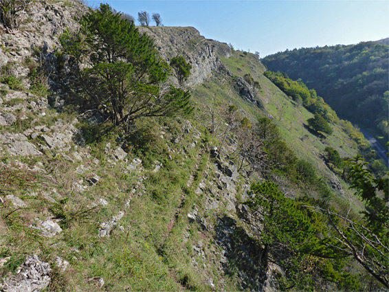
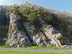
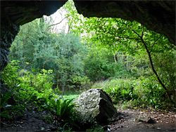
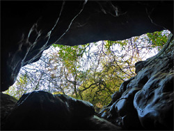
The summit is marked by several ancient burial mounds, or burrows, and it may be reached by paths from various directions, the shortest route just 0.7 miles. A longer walk, of 4 miles (loop) can be made by including a traverse of Burrington Combe, a narrow, winding, partly cliff-lined valley below the north face of the hill - similar in appearance to Cheddar Gorge on the south side of the Mendips, though less than half as long. Like the gorge, the combe has a road running through, the B3134 from the village of Burrington, and its exposed north rim can be explored via a footpath, running for a while right on top of a line of layered, carboniferous limestone cliffs, affording good views of Black Down and the lowlands to the west. The combe contains several caves, most accessible being Aveline's Hole right beside of the road, and another two in a thickly wooded side valley; Goatchurch Cavern and Sidcot Swallet. Another path follows above the south side of the combe where views are more limited owing to a belt of trees, and allows a shorter loop, just around the valley, of approximately 3 miles.
There are two main parking places along Burrington Combe, one towards the lower end, just beyond the edge of the village, the other one mile east near the upper end. The former is close to Aveline's Hole (400 feet south, on the east side of the road), which is named after geologist William Talbot Aveline. This cave is 150 feet long and has an usually wide opening, having been enlarged in the 1860s during archaeological investigations, which unearthed the remains of over 20 human skeletons, buried here over 10,000 years ago - the earliest known cemetery in the UK. Also in the vicinity, on the west side of the gorge, is a prominent outcrop of upturned limestone known as Rock of Ages, long considered to be the inspiration for the hymn of the same name, though recent studies cast doubt on this. Another parking place just south of Aveline's Hole is used if visiting Goatchurch Cavern and Sidcot Swallet, both of which are located along the wooded valley of West Twin Brook, and are also reachable from above, via a path from Black Down.
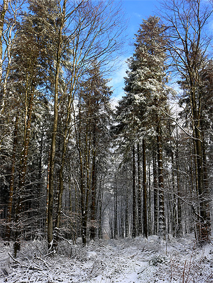
The following description is for the anticlockwise, 4 mile walk, starting from the upper carpark. One of two paths from here heads northwest a short distance, climbing through a narrow band of trees to a junction at the edge of extensive calcareous grassland, filled with numerous flowering plants in spring and summer. Bearing west, the route climbs slightly then levels out as the valley deepens steadily, and the trees below are replaced by steep cliffs of the thin-layered limestone, seen best along a lesser path that branches off, paralleling the main route. For a quarter of a mile this stays right on the rim of the cliffs, up to the point where the valley bends northwards and the slopes become wooded once more. The path enters the trees, winds around a little ravine and links with two other routes, one that descends steeply to the northern car park, the other continuing northwards past Burrington Camp, the grassy earthworks from an Iron Age fort, followed by a descent through more extensive woodland to Ham Link, a narrow lane on the east side of the village.
Ham Link leads back to the B3134, on the far side of which is another narrow road, Link Lane, which provides the next part of the route to Black Down, climbing through forest for half a mile to the start of a path, just beyond the upper edge of the trees. This path goes due south, ascending to the west end of the Black Down ridge, from where the summit is 0.7 miles east. Many other paths cross the slopes, and cross-country walking is generally easy lower down, over short grassland, but harder across the upper areas as most is covered by bracken. To the west, the open slopes give way to an extensive conifer plantation on Rowberrow Warren, also crossed by various tracks. The two caves along West Twin Brook may be viewed by first turning east along the path that follows the south rim of the combe, and then descending another trail into the valley, in which Goatchurch Cavern is slightly above the streambed on the east side, at the foot of a little rocky drainage, whilst Sidcot Swallet is a few hundred feet further down, closer to the main streambed, and just past a tiny spring enclosed by stones. Back on the rim path, the top of Black Down can be reached most easily by a connecting route that climbs southeastwards, beside East Twin Brook. The summit, also known as Beacons Batch, batch being an old Somerset word for hill, is marked by a concrete obelisk on top of one of the ancient burial mounds. From here the loop is completed by walking northeast along a wide path that descends to the edge of farmland then follows a rough track, past a house to the B3134, a short distance south of the upper parking area.