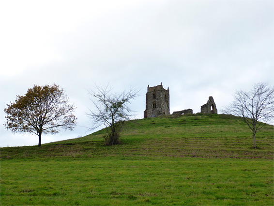
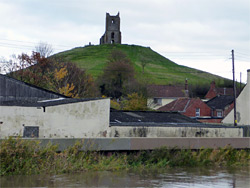
Burrow Mump is an isolated, conical hill, rising just 70 feet above the flat, marshy land of the Somerset Levels, similar to but smaller than the better known Glastonbury Tor, ten miles northeast. Both hills are topped by ruined churches, which share the same name, St Michael's Church, though are different in age.
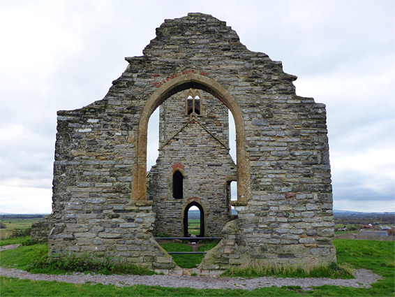
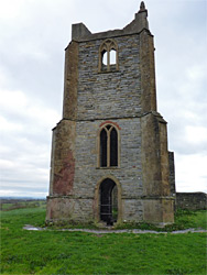
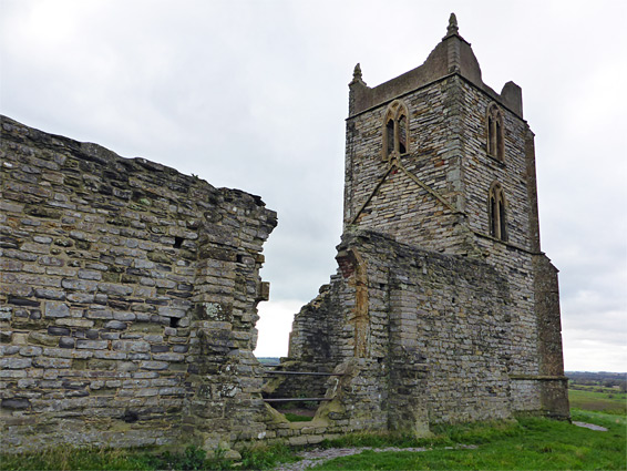
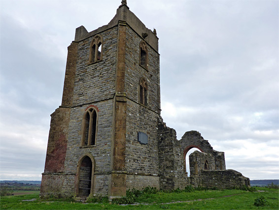
The building on Burrow Mump dates from 1793, replacing an earlier medieval church, although due to financial problems it was never finished; there is no roof, but the remaining parts - the tower, walls and arched windows - are still substantial, and the place is certainly photogenic. The flatness of the surrounding land ensures that the views from the top of the mound are extensive, despite its relatively low eminence. The site is managed by the National Trust and is free to enter, and while it may only take half an hour to walk the short path to the summit, inspect the ruin and admire the views, the place is well worth a visit.
The hill is also known as Burrowbridge Mump, named after the adjacent village, or as St Michael's Borough. It is visible from several miles away in all directions and is located beside the River Parrett near the confluence with the River Tone, reached by the A461 between Taunton and Glastonbury. The hill is an outcrop of sandstone and marl, and is about 600 feet in diameter; approximately circular in outline but with a flat and somewhat elongated top, and its sides are ringed with many parallel terraces, presumably dating from medieval times when the slopes were used for agricultural purposes, this being one of the few sites in the area not susceptible to flooding. The hill is climbed from the east side, starting from a parking area next to the main road. For much of the year the grassy sides serve as grazing pasture for a flock of sheep.
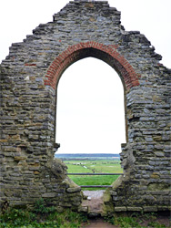
The Romans probably built some kind of structure on Burrow Mump, the Saxons (including Alfred the Great) used the hill as a lookout point, a small motte fort was constructed during Norman times, while the first church was installed sometime in the 15th century. The present church was erected in 1793 and is one of several religious sites dedicated to Saint Michael that run in a straight line, sometimes referred to as a ley line, across southwest England, also including St Michael's Mount in Cornwall, the Church of St Michael in Othery, and the church on Glastonbury Tor, though the significance of this alignment is disputed. The main components of the Burrow Mump church are a tower, a nave with three bays, a porch on the south side and a large arched window to the east, all built of grey lias (shale), and adorned with red bricks at prominent locations. Despite the lofty position, the local community preferred their church to be more easily accessible so a replacement was built in the village, and the hilltop site was abandoned in the 1840s. The ruined church and the hill are dedicated as a memorial to Somerset soldiers killed in the first and second world wars.