Famous limestone hill topped by the ruined tower of the 14th century St Michael's Church. A noted spiritual site, associated with King Arthur and other legends
On the east side of Glastonbury, between the A39 and the A361; BA6 8BG
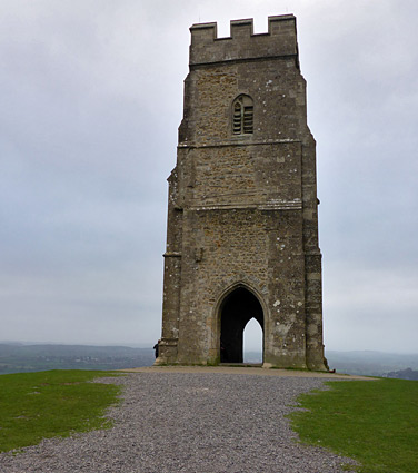
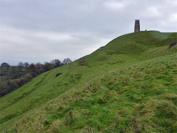
Glastonbury Tor is the most famous of over a dozen steep-sided hills that rise above the flatlands of the Somerset Levels, mostly formed of limestone; similar to but later than the Mendip Hills to the north. Like another of the hills, Burrow Mump, the peak is topped by the remains of an ancient church, dedicated to St Michael, and the combination of the stark ruin, the far-reaching views and the mythical and spiritual influences of the area make this a particularly popular and oft-visited location.
The tor is 518 feet high (158 metres), about a third of a mile long, and is part of a larger elevated area (Stone Down) up to 2 miles across, the west side of which is occupied by Glastonbury town - all is encircled by the low, marshy plains, only around 20 feet above sea level and much prone to flooding; the land has been reclaimed and partially drained over the centuries but in Anglo-Saxon times most was covered by semi-permanent water, giving the hill the appearance of an island. The tor lies at the centre of the Isle of Avalon of Arthurian legend, supposedly site of the king's final days following the Battle of Camlann, and location of the forge that created the sword Excalibur. An ancient dyke, Ponter's Ball, crosses a belt of slightly higher land on the southeast side of the tor, protecting what would have been the only overland approach.
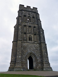
Several buildings have been constructed on the summit, the most recent being a sandstone church, part of a small monastery associated with the much larger institution of Glastonbury Abbey. The church was closed in 1539 as part of the Dissolution of the Monasteries, and all was quickly demolished and the stones re-used elsewhere, except for the three-storey tower which has survived ever since, subject to only limited restorations.
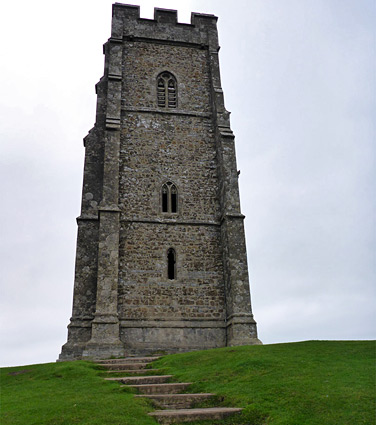
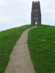
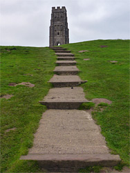
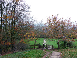
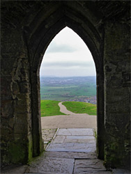
The relatively soft limestone that makes up the majority of the tor is protected from erosion by a cap of harder sandstone, from the Bridport Sand Formation. The sides are crossed by seven concentric terraces, approximately equal in height, and of uncertain origin - they may be entirely natural features, associated with bedding planes of the limestone, or be artificial, made perhaps for agriculture, defence, or even as part of a maze, guiding pilgrims to the summit. The top of the tor is accessed by two paths, one approaching along the less steep but longer western crest, the other climbing the steeper east face. Visitors are requested not to cross other parts of the slope, in order to prevent erosion. The western path is most used since it is closest to the town, starting along Wellhouse Lane, just north of the junction with the A361 and right opposite the Chalice Well, a well-known, year-round spring producing water from a deep aquifer, stained red by iron oxide. Parking in the vicinity is very limited; there is a small, fee area operated by Draper and Co along the main road, and (usually) a few free places along Ashwell Lane to the east. The path rises through a patch of woodland, past some houses, across a field and through a gate, then rises across the southern slope of the hill, cutting back briefly to the crest, which is followed all the way to the summit. The latter section ascends via many steps. The steeper eastern path begins along Stone Down Lane, which also lacks any parking places except for a few spaces reserved for disabled drivers. The lane is however served by a park-and-ride bus service, starting in the centre of Glastonbury.
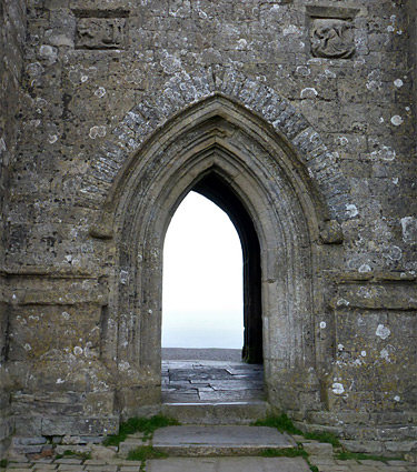
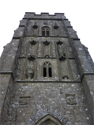
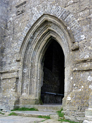
The first church on Glastonbury Tor was a wooden structure, probably erected in the 11th century and largely destroyed by an earthquake in 1275. The foundations were reused around 50 years later when the stone church of Saint Michael was constructed. This was a larger building, 80 feet long and 25 feet wide, with a square tower on the west side and a rectangular nave to the east, the foundations of which do survive, below ground. Traces of subsidiary buildings have been identified to the southeast, including living space for the priest, and probably a bakehouse. The northeast corner of the tower was built in 1804 but the remainder dates from the 14th century. Masonry features include seven narrow niches on the west front, beneath canopies, once containing sculptures. Two survive, an intact effigy of St Dunster, and the base of a statue of St Michael. Below the niches, either side of the wall above the arched doorway, are two square relief carvings. The interior of the tower contains traces of vaulting that one supported the roof and the two intermediate floors.