On the ridge north of Tickenham; parking at the local village hall; BS21 6RX
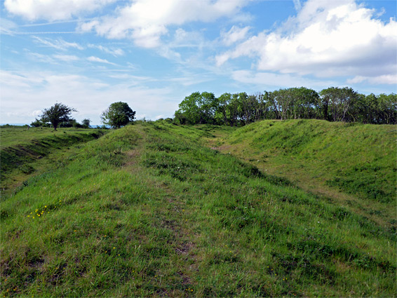
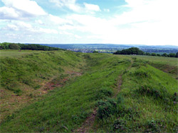
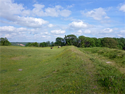
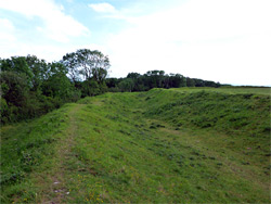
On high ground just north of the village of Tickenham in northwest Somerset, Cadbury Camp is an ancient multivallate hillfort, built during the Iron Age around 1,000 BC, and probably used until sometime during the Roman occupation, as suggested by discovery of coins, pottery fragments and a statue from that period. Like all such forts, the visible remnants are limited to low, grass-covered earthworks, in this case a pair of concentric, approximately oval-shaped ditches separated by embankments, enclosing a protected area of nearly seven acres.
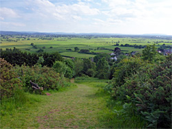
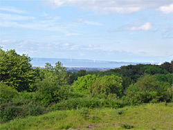
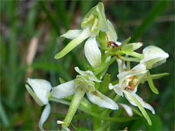
The ditches are only about 3 feet deep, the scale of the fort is difficult to appreciate at ground level, and the site is usually occupied by cattle or sheep, so overall, the immediate surroundings are perhaps not so special; instead, the best aspects are the solitude and the far-reaching views, across the Severn Estuary and the Somerset Levels. The ridgetop is also quite good for wildflowers, which include early purple and greater butterfly orchids along the edges of the enclosing woodland, and eyebright, harebell, wild thyme and rock-rose on the grassy areas.
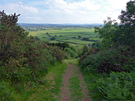
The camp is managed by the National Trust, is free to enter, and may be accessed via a half mile path that climbs from the village. The fort is built on the crest of Tickenham Ridge, a narrow exposure of carboniferous limestone that extends from Easton-in-Gordano to Clevedon.
Visitors may park at Tickenham Village Hall, in the middle of the village along Clevedon Road. The path to the camp starts 300 feet east, running northwards between two houses, alongside their lengthy gardens and up to a patch of heath, climbing quite steeply past gorse, heather and bracken, through a patch of trees to open grassland on the ridgetop. The ditches and embankments are on the highest ground, while to the southeast are the trees of High Wood, ancient woodland established here for at least three centuries, and encroaching right up to the edge of the camp. To the north, the fort is bordered by more recent woodland, formerly rough pasture. The approach path crosses the middle of the camp to a junction in the trees with the Gordano Round, a circular walking route of 25 miles. From the fort, the views north are somewhat obscured by trees, though the Severn Estuary can be glimpsed from some places, and very extensive to the south, across the Levels towards the Mendip Hills. A loop walk of 1.6 miles can be made by walking east on the Gordano Round, descending steadily to another junction, then south on a path that skirts the local golf course, passes is a group of cottages and meets Clevedon Road, 0.3 miles east of the village hall.