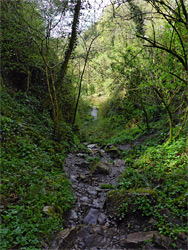
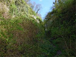
Like the famous Cheddar Gorge five miles northwest, Ebbor Gorge is a steep-sided ravine through the carboniferous limestone bedrock along the south edge of the Mendip Hills, though is quite different in appearance, being narrow, densely wooded and relatively short (half a mile), explored by a sometimes steep and rocky trail rather than a paved road. A stream flows through the lower reaches while the upper part is usually dry; the gorge is thought to have been formed by an ancient alignment of the River Axe, which long ago changed course and now emerges from beneath the hills at Wookey Hole, a short distance east.
Several paths cross the enclosing woodland, and the best way to see the gorge is via a 1.5 mile loop, descending into the lower section, walking alongside the stream a little way, climbing up the gorge - which is briefly very narrow at the top - then returning via a slightly less steep path along the rim. A short spur leads to a fine overall viewpoint, above the trees.
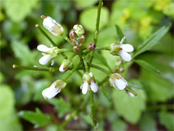
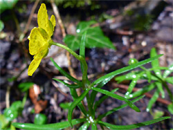
Ebbor Gorge is owned by the National Trust and administered by Natural England as a national nature reserve. It is also a site of special scientific interest, designated as such in 1952, on account of the plant and animal life, and for being surrounded by an excellent example of ancient, calcareous woodland. The moist and sheltered conditions are especially suited for ferns, fungi, mosses, liverworts and lichens; because of the shade, wildflowers are not so varied, and in general the most visible species are all common, including bluebell, wood anemone, wild garlic, dog's mercury, buttercups, sanicle and primrose. A different plant selection is found in the small, grassy clearings along the rim. Within the gorge are openings to at least five caves, in two of which (Savory's Hole and Outlook Cave), Neolithic and bronze-era relics have been found, together with assorted mammalian fossils.
The gorge is reached by a short walk from a spacious, free parking area (locked at dusk) along Deerleap Road, 3 miles northwest of Wells. The path descends steeply into the adjacent valley of Hope Wood, which contains a small stream, flowing over the impermeable layer of millstone grit which underlays the limestone, and then forks. The two branches form a short loop downstream, running either side of the creek, up to the point where it meets the usually dry channel from Ebbor Gorge itself, to the north. From here one path climbs the gorge, gaining about 200 feet, and another continues downstream, both soon meeting the long-distance West Mendip Way, which allows another loop.
The Gorge
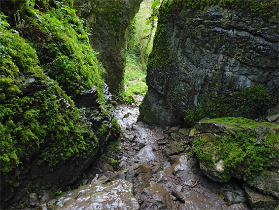
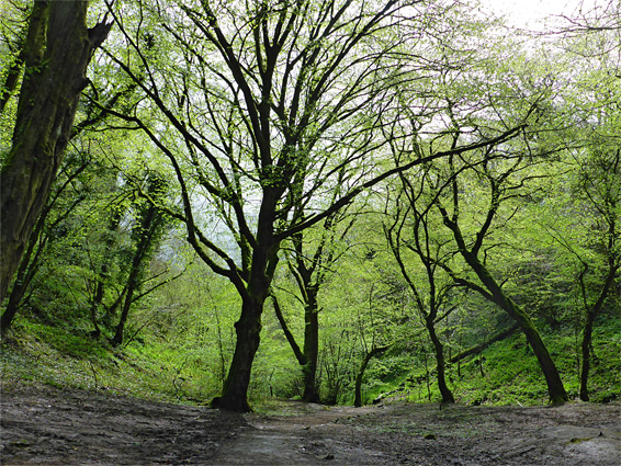
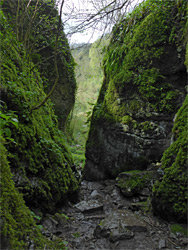
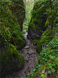
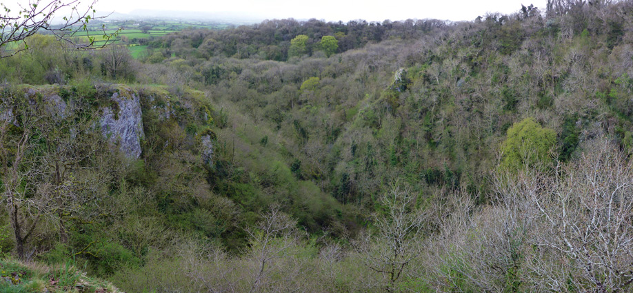
The trees on the north side of the stream are part of Ebbor Wood, which consists mostly of ash and oak, with some beech, whitebeam and field maple, while in the gorge itself the ash predominates. The lower reaches of the gorge are quite overgrown, and the limestone sides are mostly obscured by the vegetation, but the upper end is rockier, framed by vertical cliffs. The highest section is especially enclosed and twisting, the walls covered with bright green moss - the most photogenic part of the ravine. Above the narrows the drainage becomes very shallow, running through more open woodland for another 0.4 miles, past a few more limestone outcrops, but there is no trail in this area. Just above the narrows, the path meets the West Mendip Way, and a right turn leads to a short spur to the cliff-edge viewpoint, looking southwest along the gorge towards the Somerset Levels. The main path also has some views, eastwards, before descending steadily through the tall woodland to another junction that links with the initial loop through Hope and Ebbor woods.