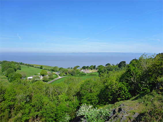
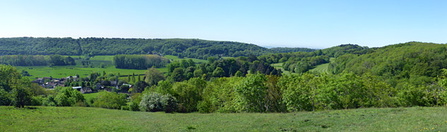
Secluded nature reserve on top of a ridge overlooking Gordano Valley and the Bristol Channel; a sizeable area of unimproved limestone grassland, surrounded on most sides by woodland
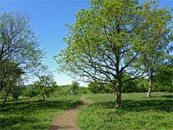
Walton Common Nature Reserve comprises 65 acres of woodland, scrub and unimproved grassland, on top of a long, narrow ridge on the northwest side of Gordano Valley in north Somerset, half a mile from the Bristol Channel coast. The trees grow mostly on the sloping ground along the edges of the reserve - Hack's Wood to the south and Canon's Wood to the north, leaving the ridgeline mostly open, allowing fine views south, across the valley towards Tickenham Hill. The northern trees are more extensive and the views limited but the coast is visible through a gap at one corner, at the site of an ancient quarry.
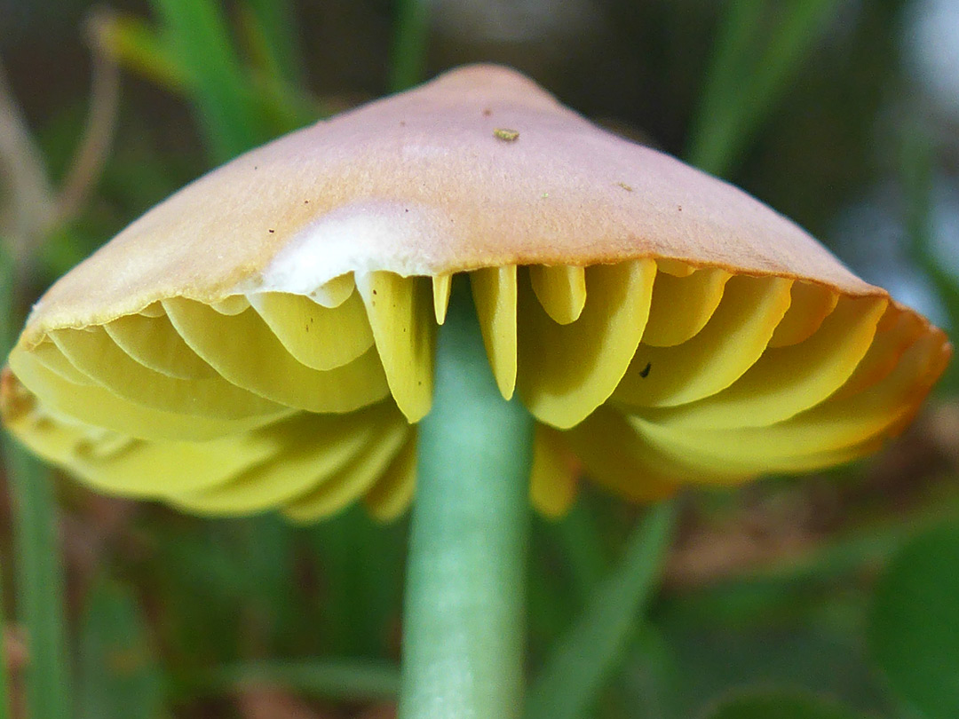
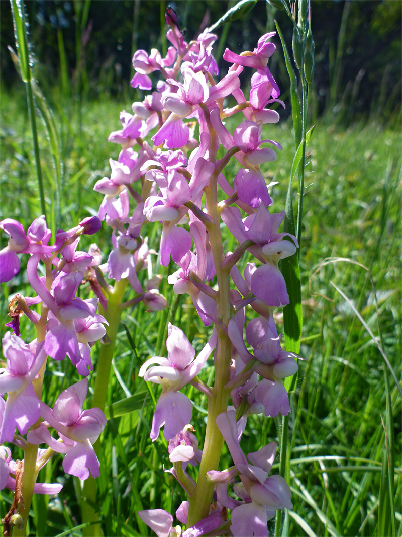
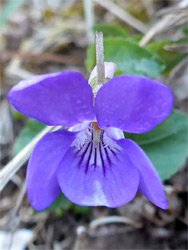
The underlying rocks are carboniferous limestone, and as result the reserve contains a wide range of calcareous plants, the majority relatively common, such as harebell, yellow-wort, salad burnet, wild thyme, dwarf thistle, lady's bedstraw, oregano, common rock-rose and common centaury, plus several types of St John's-wort and violet. Minor variations in soil type and thickness result in slightly different vegetation and plant distribution across the site, which contains more species than might be expected for an area this size, accompanied by a corresponding diversity of insects; the place is especially noted for butterflies, with around 30 species recorded. Rarer plants include autumn gentian, autumn lady's-tresses, common spotted orchid and early purple orchid. The common is also a site of special scientific interest, on account of the habitats and wildlife.
The reserve is seasonally grazed by a small herd of Dexter cattle, kept in place via collars that interact with hidden electric fences. The ridgetop is also the site of several ancient earthworks; a tumulus, several hut circles, ridges from a field system and a larger circle, known as the Banjo, but all are indistinct and not easy to identify, especially when covered by vegetation in spring and summer. The field system, now wooded, extends northeast beyond the reserve boundary.
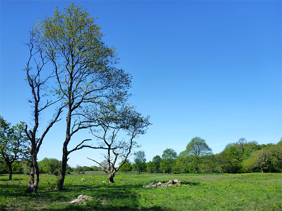
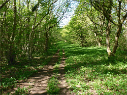
The reserve entrance is along Walton Street, north of Walton-in-Gordano; parking places are available on a verge on the west side of the road shortly after the last house in the village, and just before the edge of Clevedon Golf Course. The rather hidden path up to the ridge starts on the opposite side of the road; it climbs through a patch of trees (Plumley's Wood), and soon emerges to sloping grassland, with sweeping views across Gordano Valley. From here, three approximately parallel paths cross the reserve, two through woods along the north and south edges, and one across the open land at the centre, linked by several connecting routes. The two best areas for views are near the entrance, facing south, and above the old quarry in the northwest, looking out across the sea, 250 feet below. The quarry also has the best concentration of plants in a small area, growing in crevices and on benches; care is needed if climbing down the steep, slippery rock faces. Overall, the reserve is surprisingly extensive, and several hours could be spent exploring. The first wildflowers appear in March, and the last in September.