Worlebury Hill is a steep-sided ridge about 2 miles long, on the north side of Weston-super-Mare, formed of the same limestone responsible for the similarly shaped ridges of Sand Point to the north and Brean Down to the south. Unlike these two, both narrow and covered only by short grass, Worlebury is much broader, and thickly wooded, though it too is bordered by a rocky beach, along the north edge, extending westwards to a rounded peninsular opposite the tidal island of Birnbeck, which is connected to the mainland by a disused pier.
Several paths cross the woods towards the top of the hill, where the main feature of note is the overgrown remains of Worlebury Camp, an Iron-Age hillfort, though there is no coast path hereabouts, partly as the northern slope is steep, and a road runs all along the lower edge, about 30 feet above sea level.
The coast can instead easily be explored walking along the beach, which is mostly mud or rock with just a few sandy patches, and for 1.5 miles is lined by low, layered cliffs that are sometimes quite colourful. There are several erosional features of note including an arch, several short caves and some jagged sea stacks - the only band of rock formations between the otherwise sandy coast that extends for over six miles either side of Weston. The walk can be extended a little, if visiting for several hours either side of low tide, by walking across to Birnbeck Island, the top of which is occupied by the ruins of an amusement centre, and is fenced off, though the whole of the perimeter may be viewed. The round trip distance, including a loop around the island, is just over three miles.
Free parking is available at the south end of Beach Road, just off Kewstoke Road, the route all along the north edge of Worlebury Hill. Most people seem to come here for walking on the dunes and sandy beach to the north rather than the rocky section towards Weston.
Worlebury Beach
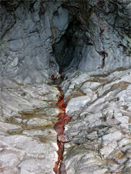
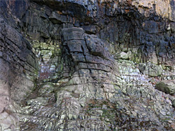
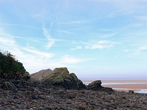
West of the Beach Road parking area, the sand soon gives way to stones and muddy patches, crossed by a few lines of bigger rocks, perpendicular to the shore. Low cliffs rise up, formed of light grey limestone, in places crossed by dull reddish or orange bands. The road just above is always close, though mostly obscured by the trees. The first feature of interest is an angular arch, its opening about 15 feet high, then a little further is a patch of protruding rocks, their jagged surfaces covered by yellow lichen. At Black Rock, half way along the beach, the cliffs curve inwards forming a natural amphitheatre, containing several small, wave-polished caves, one centred on a narrow vein of deep red-coloured rock. The limestone above the caves is particularly dark. One other named feature, 650 feet beyond, is Bathing Cove, a narrow, pebble-lined inlet with a small gully at its upper end. Beyond here, the trees soon fade away as the far end of the peninsula approaches, dominated by Birnbeck Island and its pier.
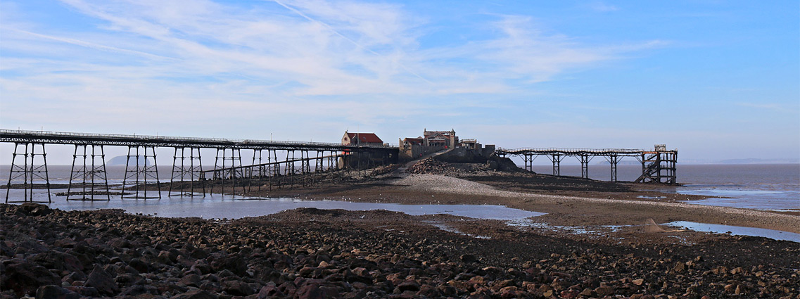
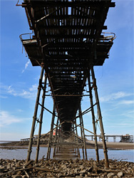
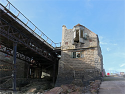
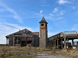
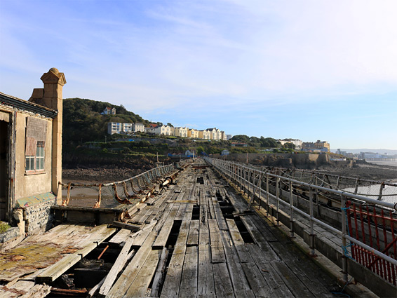
Birnbeck Pier was constructed between 1864 and 1867, and is just over 1000 feet long, notable for being the only pier in the UK which connects to an island. The previously isolated island, once home to several rare plant species, was also developed around this time, housing an amusement arcade and lifeboat buildings, and remained a popular attraction until the 1930s, when the opening of the more centrally located Grand Pier caused visitation to decline. Some facilities on Birnbeck stayed functional until 1994, when the pier was closed following storm damage, and the surviving buildings on the island were fenced off.
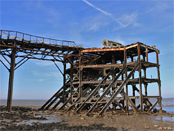
Access to Birnbeck Island is still possible, around low tide, by walking along a natural stone causeway to the northeast; the middle part of the pier stands above open water even at lowest tides. The causeway leads to a boat ramp at the east end of the island, above which are the ruins of a lifeboat house built in 1889, and connected to the pier from its upper floor. The remaining buildings are behind the perimeter fence so cannot be entered, and the pier itself is clearly unsafe to walk upon. There was once another pier on the far side of the island, built to allow ships to dock even at low water, but this was dismantled in 1923, while a third pier, or slipway, was added in 1902 on the southeast side, used for launching of lifeboats. Another component of the original complex still just about surviving, though scheduled for demolition, is the north jetty (open 1905), an imposing iron structure that has been greatly damaged by storms. The buildings on the island seem also destined for removal but the pier itself is likely one day to be restored. It is easy enough to walk all around the island below the built up area, and while there are no especially photogenic rock formations, the views up and down the Bristol Channel are very good.