Layered cliffs, sandy beaches and eroded limestone formations along the Glamorgan Heritage Coast; also a cliff-side waterfall and the remains of a castellated mansion
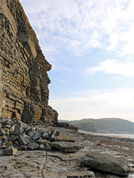
Dunraven Bay, also known as Southerndown Beach, is the most visited location along the Glamorgan Heritage Coast, a 14 mile section of the shoreline of Vale of Glamorgan in south Wales, similar in grandeur and geological interest to the Jurassic coast of Devon and Dorset, though rather less known. The designated section runs from Ogmore-by-Sea in the west, adjoining a large area of dunes beside the River Ogmore, and St Athan in the east, and is characterised by tall, vertical cliffs of thin-layered limestone and shale, coloured grey to yellow and brown, above wide beaches of either grey pebbles, golden sand or terraced rock, this latter where the slightly inclined strata have been eroded by the waves to form straight or curving ridges, and other more irregular formations.
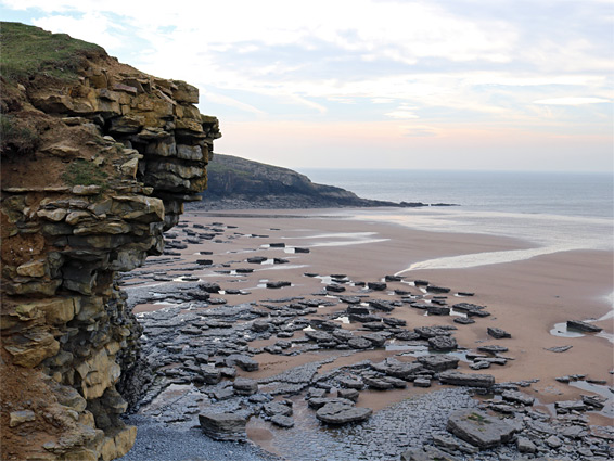
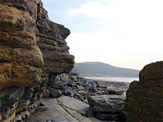
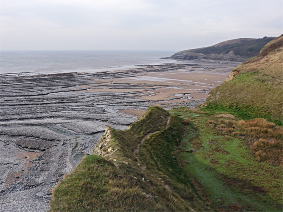
The bay at Dunraven is the largest sandy area with relatively easy access, since it is situated at the mouth of a valley, and the sides allow an approach by road, from the nearby village of Southerndown; similar beaches further southeast along the Heritage Coast lie at the foot of sheer cliffs that prevent any quick access from above. At high tide at Dunraven Bay only rocks and pebbles are visible, though the sands are soon revealed as the waves retreat. The beach is bordered by the promontory of Witches Point (Trwyn y Witch) to the east, and by flat rocks to the west, which can be followed for about two thirds of a mile before a cliff-bound section puts an end to progress.
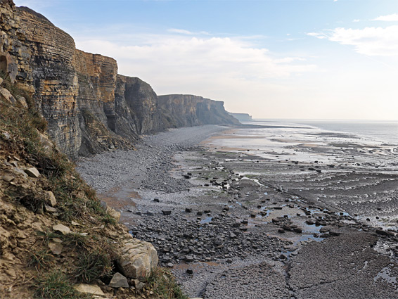
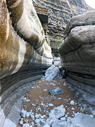
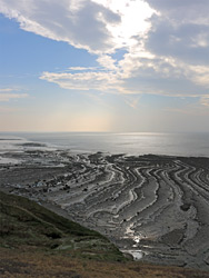
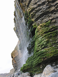
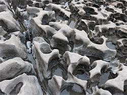
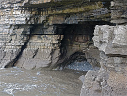
The rocks at Dunraven Bay form an array of photogenic features including alcoves, stepped terraces, short caves, narrow channels and curious, small scale pinnacles and hollows. Further east, the far side of the promontory gives way to more long beaches, of sand and stone, beneath a lengthy series of tall, layered and somewhat unstable cliffs. These are explorable from below via a path down the promontory; the initial section is known as Temple Bay. Also of interest in the vicinity is a cliff-side waterfall, a walled garden and the remains of a grand manor house, Dunraven Castle, built on the site of an ancient hill fort.
The cliffs either side of Dunraven Bay are part of Southerndown Coast, a Site of Special Scientific Interest, which incorporates 3 miles of the shoreline, from near Ogmore-on-Sea to the vicinity of Marcroes. The cliffs are mostly formed of blue lias, a sequence of carboniferous limestone layers from the Triassic period, folded and tilted in places but otherwise level, while Witches Point is composed of Sutton Stone, a lighter-colored limestone which overlays the blue lias and represents an unconformity, with a gap between the two strata of around 150 million years.
Beach Road from Southerndown ends in a small carpark, free during the winter; at popular times a larger parking area is available just beyond on a grassy hillside, charged at £3.50 for stays longer than one hour. A side road leads to the Glamorgan Coast Heritage Centre, a gift shop and information building, and there is also a seasonal cafe. The upper edge of the bay is lined with a band of large pebbles, 150 feet wide, below which is the sand, up to 1000 feet of it at low tide. To the northwest and especially the southeast, the upper margin of the sand mingles with boulders and rocky spurs, beneath the colourful cliffs of thin, level, limestone strata. Walking around the headland of Witches Point, at the south side of the bay, is not possible except around the lowest tides, but the rocks to the northwest allow easy walking for over half an mile; the band of flattish limestone gradually narrows as the strata become a little more inclined, until an overhanging section of cliffs above an inlet between sheer rocks, seemingly not passable.
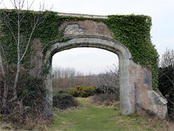
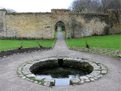
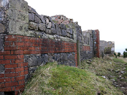
The track to the hillside parking area continues a little further to the Dunraven Walled Gardens then curves back round to a ridge just above, site of Dunraven Castle. Several structures have existed on the site including a 12th century fort, but the most recent was a castellated mansion of the Wyndham family, completed in 1806. This served as a residence until after World War II and then as a hospital and hotel, but its owners decided the place was uneconomical to maintain, and in the absence of any buyer, most was dismantled and the materials sold, in the 1960s. Remaining sections include the foundations of the walls, a few pathways, and an arch; just enough to discern the footprint of the building and appreciate its size. The gardens below are still maintained and are enclosed by the original walls. They are divided into four sections, separated by dividing walls, and one corner adjoins a circular, two floor tower, once used to store ice.
The Coast Path follows the top of the cliffs on the southeast side of Witches Point, giving excellent views of the sands and terraces below, but does not descend to beach level again for 2 miles, at the valley of Cwm Nash. The north side of this section is accessible, however, via a short trail down the south side of the promontory, descending quite steeply to a point about halfway along, above limestone ledges which give way to sand a little lower. Rising tides can make this entry location inaccessible before the upper part of the main beach is covered, hence care needs to be taken to avoid becoming stranded. For half a mile south of the initial sandy section, the beach is nearly all rock, crossed extensive, curving ridges and gullies, extending a little way beyond the hanging valley of Cwm Mawr, which contains a stream that forms an elongated waterfall about 40 feet high. Beyond here the beach becomes mostly sandy, for the 3 miles to Nash Point near Marcross.