Chalk downland and ancient monuments at the west edge of the West Wiltshire Downs; good views and a wide range of wildflowers including several rare species
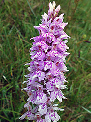
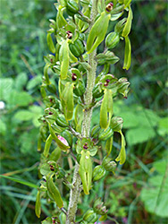
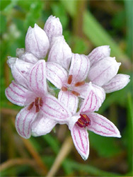
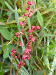
Near the west edge of the West Wiltshire Downs, White Sheet Hill, or Whitesheet Hill is a steep-sided, flat-topped peak, notable for the wide range of chalk grassland plants which grow here, the rarest being burnt-tip orchid, frog orchid and meadow saxifrage. The importance of the hill is recognised by its designation as a Site of Special Scientific Interest (SSSI), and all this area lies within the West Wiltshire Downs and Cranborne Chase AONB.
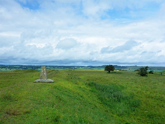
The hill is managed by the National Trust and is also of interest for a series of ancient earthworks, from an Iron Age hillfort on the highest point (802 feet), and a Neolithic camp on a slightly lower summit to the north. A track running between these two was once a Roman road, and elsewhere in the vicinity are 11 burial mounds or tumuli, the oldest around 2,000 BC, so the hill clearly has a long history of use, though today, it is the wildflowers that provide the main reason to visit, together with the views, which extend for many miles across the lowlands to the west.
The hill occupies the southern half of White Sheet Down, which includes an extension of the high ground to the north, and is connected to the main part of the Wiltshire Downs by a narrow neck of land to the east, just outside the SSSI. White Sheet Hill is reached by a narrow, tree-lined lane, leading to a parking area right below its western tip, and about one hour is needed to visit.
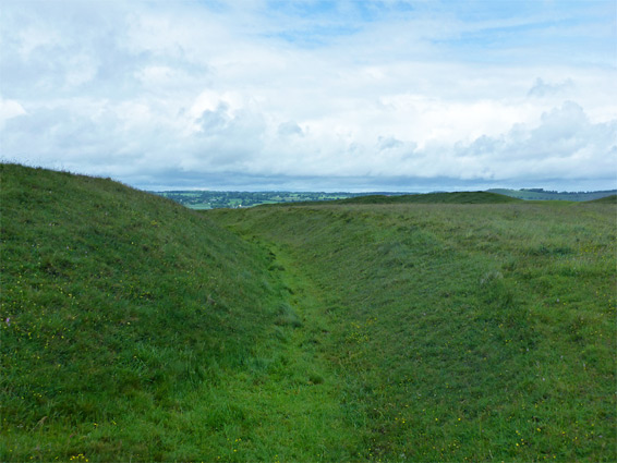
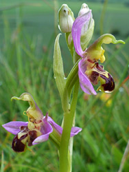
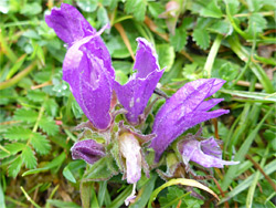
The good-sized parking area below White Sheet Hill is reached via the (paved) White Sheet Lane, branching eastwards off the B3092 near the town of Mere. Beyond, the lane becomes unpaved as it climbs the hill, runs through the Neolithic camp and continues to a junction with the B3095, another road from Mere. From the car park, a path ascends the slope and runs along the rim of an old chalk quarry, whose sides provide shelter for good range of wildflowers including the bee orchid. The path swings round to the southeast, crosses an ancient ditch and leads to the top of the hill, location of the fort; remnants consist of two concentric lines of embankments and ditches, the west and south edges of which follow the natural contours of the slopes below. The grassy earthworks harbour the burnt and frog orchids, though populations of both are limited to just a few dozen plants. Another rare species recorded here is field fleawort, though this seems to bloom only intermittently and may be absent in some years. The path later joins the West Wiltshire Way - to the south this descends a narrow ridge towards Mere and to the north crosses a larger area of downland, Rodmead Hill.