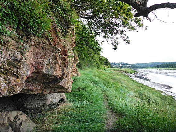
270 degree bend along the River Avon, a Site of Special Scientific Interest because of several rare plant species; comprises woodland, cliffs and saltmarsh
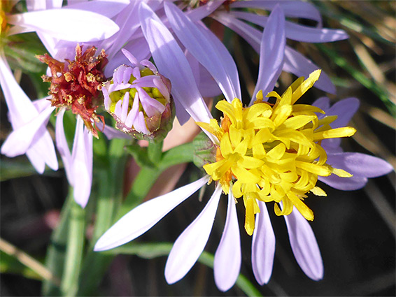
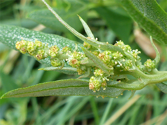
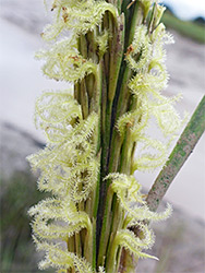
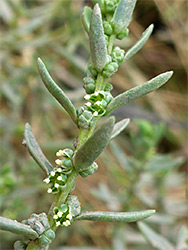
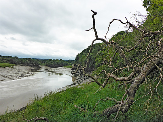
Horseshoe Bend is the semi-official name of a short stretch of the River Avon in Shirehampton, west of Bristol, where the river curves by 270 degrees and is bordered on the north side by a low cliff of sandstone, from the Portishead Formation. A narrow, 0.4 mile section of the north shore is a Site of Special Scientific Interest (SSSI), comprising the cliff, the wooded slope above and a band of saltmarsh below, so-designated because of several unusual plant species that grow here, principally the true service-tree (sorbus domestica) for which this location holds the single largest population in the country. Other notable species are two varieties of whitebeam, and large-leaved lime, in the woods, pale St John's-wort and field garlic on the rocks, and long-stalked orache and slender hare's-ear in the saltmarsh.
The site is not signposted, has no official entrance, and access is somewhat complicated by a railway that runs right along the northern edge, yet it is still relatively easy to explore, approaching along a path from the Portway, which passes under the railway, from where it is possible to walk through the SSSI almost to its western end, along the upper edge of the saltmarsh. The rocks are exposed on several locations, and are quite colourful, while the site as a whole is pleasantly scenic, with good views up and downstream, and south towards Leigh Woods.
The closest parking places are along roads off Sylvian Way, north of the Portway. A path starts directly opposite the junction, entering some National Trust land, descending through a patch of trees, veering east alongside a field then under the railway to a grassy area, separated from the river by the band of saltmarsh, which narrows abruptly to the west. A fainter path leads upstream, into the SSSI, soon running between the base of the wooded slope and the saltmarsh, this around 30 feet wide. Near the northern part of the river bend, the path climbs to a little concrete bench, where some steps lead up to the railway; beyond, the path becomes a little less distinct as it progresses to the far end of the SSSI, beyond which the woodland gives way to fields and houses.