Coastal walk mostly high above the sea, along the top of big cliffs, but with various sea level access points. Beaches, arches and other wave-carved formations
Management
National Trust
Location
Lee Bay; EX34 8LR. Kiln Carpark, Combe Martin EX34 0DN
The north Devon coast either side of Ilfracombe, from Lee Bay in the west to Combe Martin in the east is generally cliff-bound, and many points at sea level are impassable even at low tide, so walking along the coast path is the only way most people see this section, though there are a number of bays and beaches that are reachable, some straightforwardly, where the land slopes down to allow roads to approach, others with more difficulty, at the end of steep trails.
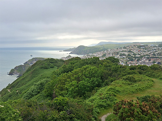
The one-way distance between the two places, along the coast path, is 7.5 miles so a round trip walk takes most of a day, especially if a few side trips are added. West of Ilfracombe, the coast is generally empty and rugged, with very few shoreline access points, while from Ilfracombe to Combe Martin it is rather more developed, and a little lower in elevation.
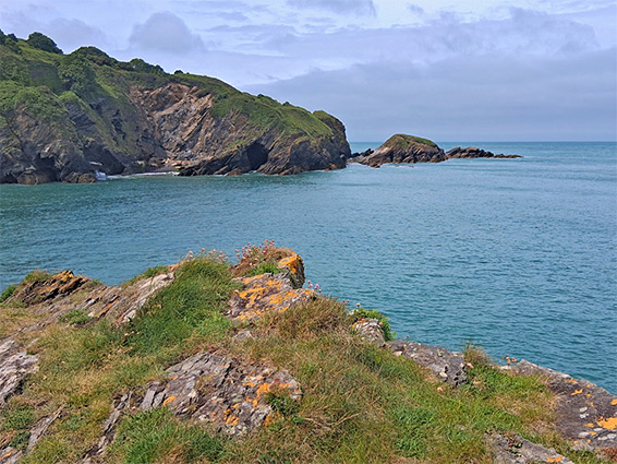
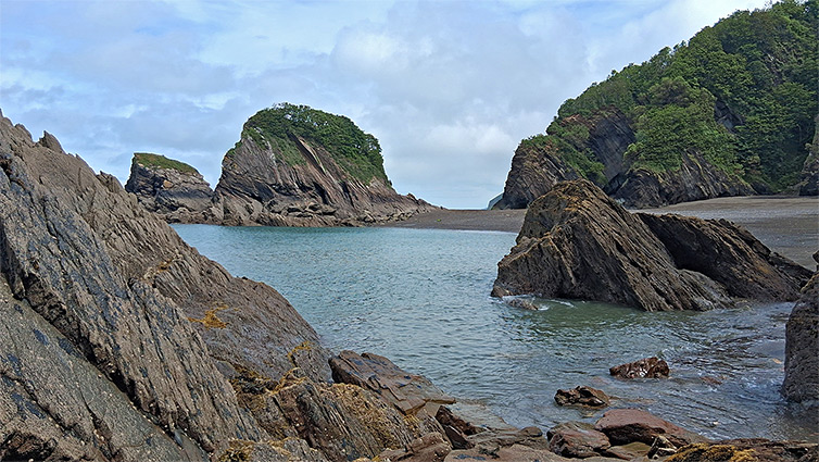
All the bedrock in this region is slate - dark grey, thin layered, inclined, and eroded into jagged shapes including sea caves and arches, and forming cliffs up to 400 feet high. The western third is the Morte Slate Formation, extending from Morte Point, the middle section, either side of Ilfracombe, is the Lentisbury Slate Member, while further west is mainly the Combe Martin Slate Member, with just a small exposure of the Lester Slates and Sandstones Member.
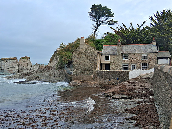
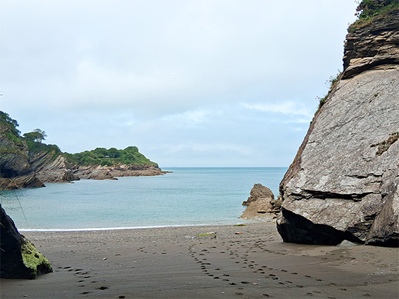
At Lee Bay a few picturesque stone buildings overlook the inlet, including a former corn mill right at the high water line, with a new housing development being built just inland, replacing an old hotel. The main part of the village is a third of a mile further inland, along the one access road. At low tide it is possible to traverse the exposed slate terraces to a secluded sandy beach a little way east, Broadoar Bay, but otherwise, walking eastwards is only on the coast path, which initially follows a dead-end road, climbing quite steeply past fields and a few houses, then out to open moorland, reaching a high point of 570 feet. The main route, a former vehicle track, then moves further away from the coast and starts a steady descent towards Ilfracombe (this section is Langleigh Lane), but the coast path branches off, crossing a grassy valley above Hazel Bushes Bay and Breakneck Point, and traversing more undulating land, the Seven Hills, where the path is known as the Torr Walk. A short side path descends, partly by steps, to White Pebble Bay, a cliff-lined inlet, after which the path also soon reaches Ilfracombe, emerging beside a street, also named Torr Walk.
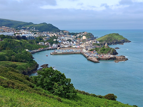
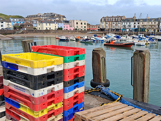
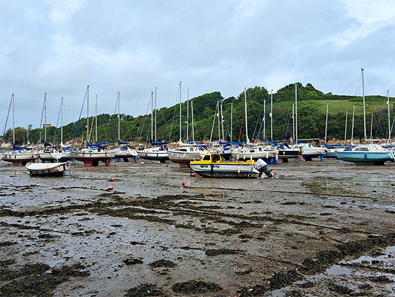
The sea cliffs are still high at the west side of Ilfracombe, though an otherwise inaccessible beach at the base may be reached via a pair of constructed tunnels, dating from the 1820s, built by Welsh miners, thus allowing residents and visitors to bathe in the sea. A fee is still charged for access however the tunnels have been closed for several years due to a landslide. Instead, sea level access is possible short distance east, where the cliffs slope down to a beach, at Wildersmouth, beyond which is a promontory, Capstone Hill, and then Ilfracombe Harbour, near the east edge of town.
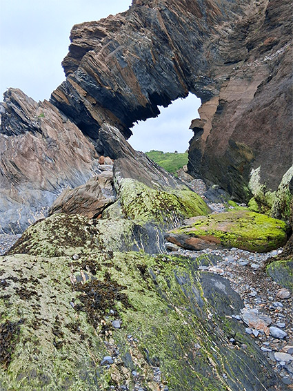
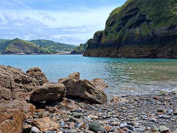
The coast path runs along the south side of Ilfracombe Harbour, round two small inlets, Larkstone Beach and Rapparee Cove, this containing a small sandy beach, and reachable via a flight of steps. The path then climbs a hill - Hillsborough, site of an ancient earthwork, and now a local nature reserve. Just past the summit, the trail descends steeply, via switchbacks, through wooded terrain, down to Hele Bay, a popular beach right beside the A339. At low tide a photogenic arch may be reached, on the west side of the bay, just round a small headland.
From Hele Bay the coast path follows the main road a while before branching off, curving across a promontory, Rillage Point, above the inaccessible Samson's Bay, round a larger headland, Widmouth Head, and past the private Widmouth Beach before returning to the road (A339) as it descends towards Water Mouth, a long inlet with cliffs on the north side, and a half a mile of muddy beach exposed at low tide. There is a marina here, and also a holiday park, to avoid which the coast path moves inland for a while, then passes through a campsite and enters the fields beyond, rising once more and entering wooded surroundings, close to the coast once more. 250 feet below is Broad Strand Beach (known as Broadsands Beach), a scenic place lined by high cliffs; mostly sandy but with sea stacks and arches to one side, and a small island to the other, Hamator Rock, climbable at low tide.
The steep path down to Broad Strand Beach was closed in 2025 due to a major landslip, and a decision on repairing it is yet to be made. Instead, access is possible via sea, or by descending another path that reaches beach level a few hundred feet east, near Golden Cove, then walking back west. Close by, another long-closed path drops down to the coast at Sandy Bay, but this one is still quite easily traversable, with only some minor landslip damage right at the lower end. The remainder of the walk on the coast path to the main beach at Combe Martin, about half a mile, is along tracks or residential streets, past an increasing number of houses.