Short, geologically varied section of the Jurassic Coast, including sea stacks (Mupe Rocks) at Bacon Hole - a circular bay, and the Fossil Forest - remains of ancient trees
Location
West Lulworth; BH20 5RQ
Walk
1.7 miles - across Lulworth Cove then along the coast path to Mupe Bay, plus short diversions to the Fossil Forest and down to the shoreline
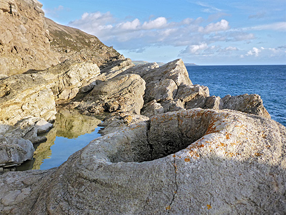
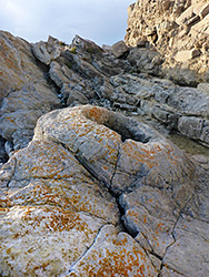
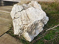
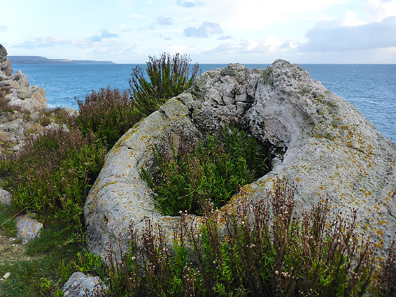
Most visitors to Lulworth Cove walk west to the famous arch of Durdle Door; the coastline to the east is much less explored, though equally interesting, geologically. A walk of 1.6 miles passes three notable sites; the first, and most unusual, is the Fossil Forest, an inclined ledge above a short cliff where fossilized wood has been excavated, and also thrombolites - circular concretions formed by cyanobacteria, many of which developed around the base of trees and hence contain a large hole at the centre, where the wood used to be.
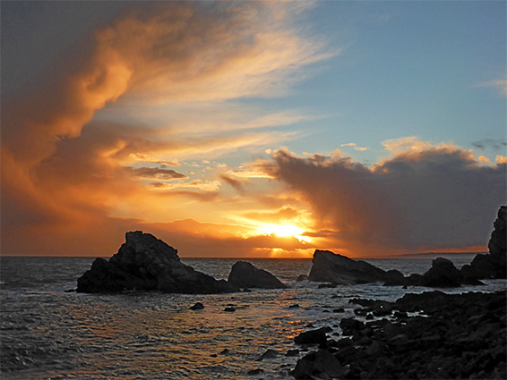
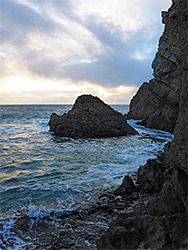
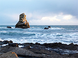
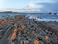
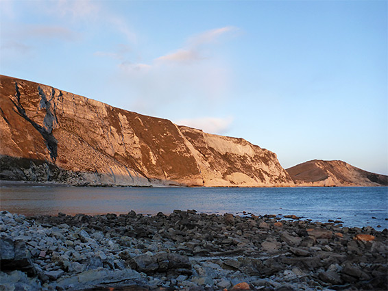
Half a mile east is Bacon Hole, a semicircular bay, a smaller version of Lulworth Cove, lined with photogenic sea stacks, inter-tidal ledges and rock pools. Not far beyond is Mupe Bay, a wide inlet backed by a sheltered, narrow beach below chalk cliffs. The coast path passes above these three places, and a flight of steps leads down to the Fossil Forest, while the Hole and the Bay are reached by short diversions.
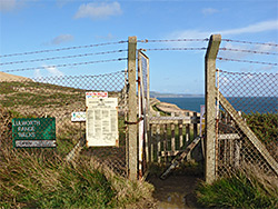
All the land bordering this part of the coast is within the Lulworth Range, an MOD facility used by the army. The range is enclosed by a fence, the west entrance being just above Lulworth Cove, and entry is only possible on non-firing occasions, typically two or three days each week. The area is patrolled by wardens at other times to stop trespassers. The firing schedule is available online.
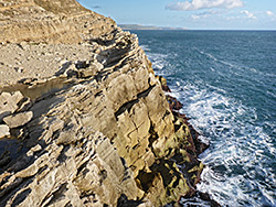
Lulworth Cove is provided with a large parking area, managed by the Lulworth Estate. The access road ends at the cove, beside the eastwards coast path, which has to climb steeply, by 300 feet, to pass the tall cliff of Purbeck limestone that forms a backdrop to the stony beach. The path then descends, to the coastal plateau, around 40 feet above the sea, and is linked to the far side of the cove by a short side path, so it is quicker to reach this point, from the road, by walking across the beach, an option possible nearly all times, except perhaps around the highest tide.
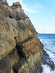
Beyond the cove, the coast path heads due east and very soon reaches the gate marking the edge of the Lulworth Range, immediately after which is a sign pointing the way to the Fossil Forest - along a little side path, through another fence and down several flights of steps to the west end of the narrow, quarter of a mile-long ledge on which are found the fossils. All the rocks hereabouts are from the Purbeck group; the lower component is the Hard Cap, while around the fossils is the Lower Dirt Bed then just above are the Soft Cap and the Broken Beds, this a mass of jumbled limestone breccia. Although petrified wood is seemingly not visible in situ (though there is a large specimen on show beside the steps), numerous fossil thrombolites are visible including several dozen with tree casts at the centre. Sea level is accessible in just a few places, by climbing down stepped gullies of 20 feet or so, otherwise the cliffs are too steep. There is no official path up at the far (east) end of the fossil ledge though the coast path can be reached by carefully scrambling up the grassy slopes above.
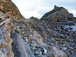
Further east, the coast path moves slightly inland to bypass a gully then reaches a viewpoint above Bacon Hole, a steep-sided, semi-circular inlet backed by inclined strata from the Purbeck Group. There is no path down but the stony beach can be accessed by descending the steep grassy slope, or by walking a quarter mile further, where an actual path does lead to sea level - at Mupe Bay - then heading back west along the beach. At the mouth of Bacon Hole is a line of sea stacks, the Mupe Rocks, extending in a straight line off to the east.
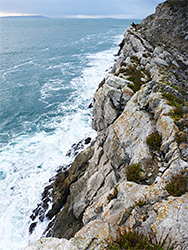
East of Bacon Hole is a short stretch of cliffs and rock formations, leading to a promontory where the land curves northwards and the rocks give way to the sands of Mupe Bay. A sea-level extension of the promontory is the Mupe Ledges, a semi-submerged reef formed of the middle and upper Purbeck limestone. The southwest end of Mupe Bay is accessed by the side path, which has steps at its upper end, and it extends for nearly a quarter of a mile, until the sand and pebbles are replaced by large chalk boulders from a fairly recent landslip. These can be passed; on far side is the end of the original beach, before a sheer cliff, its base submerged even at low tide.