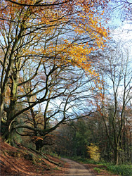
Peaceful, hidden valley in the Cotswolds, containing an unfinished Victorian mansion, a chain of lakes, grassy slopes and extensive woodland, crossed by paths and tracks
Woodchester Park, a National Trust property between Nailsworth and Stroud in central Gloucestershire, is a sizeable area of pasture and conifer plantations mixed with patches of more ancient woodland, extending nearly three miles along a secluded valley near the western edge of the Cotswold escarpment, though sloping down to the east, where it meets the larger Nailsworth Valley.
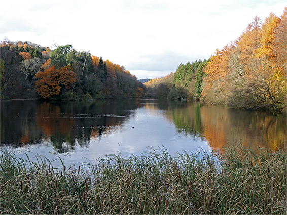
Woodchester was between the early 1600s and 1843 the residence of a wealthy family, the Ducies, who constructed an elegant mansion and partially landscaped the valley floor, initially installing a series of fishponds along a seasonal stream then later expanding these to form small lakes, at least two of which were used for boating.
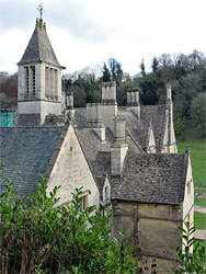
Formal gardens were laid out and the estate became one of the finest in the county, until escalating cost of repairs forced the family to sell the site in 1843, and thereafter reside only in another mansion they owned, at Tortworth. The buyer was William Leigh, a merchant from Liverpool, and after deciding that restoration was impractical, he instead arranged for the Georgian house to be demolished, and began work on a Gothic-style replacement. The exterior of this was complete by the 1870s though the interior was never finished, in part due to lack of funds. Since then various minor works have been carried out and the mansion is now partly furnished, not inhabited, but open for tours and other events. The main appeal of the estate, however, is the peaceful, picturesque grounds, now giving the appearance at least of a natural landscape, since the formal gardens have long since vanished and the lakes are entirely in harmony with the wooded surroundings.
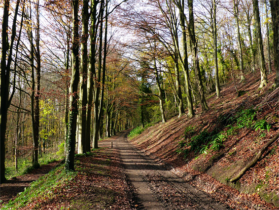
Various paths and tracks cross the woods and grassy areas, enabling loop hikes ranging in distance from less than 2 miles, to the mansion and the nearest lake, to over 7 miles if visiting all the lakes and seeing some of the upper plantations along the valley sides.
The official entrance to the estate, used if driving to the mansion (by invitation only), is along the B4066 just north of Coaley Peak; the unpaved road crosses a field, passes the original gatehouse then enters woodland, descending gradually to the house, which is situated near the upper end of the valley. Walk-in visitors start from a car park a little way south, at the end of a quarter-mile track, linking to the road via a short path. A fee is charged to park here though vehicles can be left at the start of the track without payment. The valley is open every day of the year between dawn and dusk.
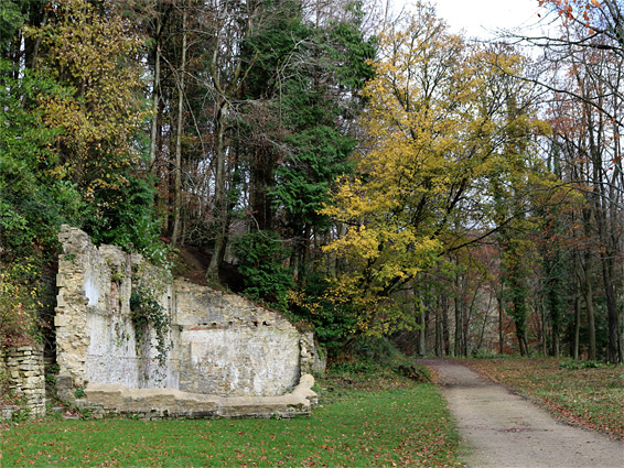
The entrance road leads through a patch of tall trees then runs alongside grassland, seasonally grazed by belted Galloway cattle. A path on the left forms part of a short loop through the adjacent forest (Marmotsflat Wood), while the road also forks not far beyond, close to the mansion. The right branch goes to the house then further along the valley while the left route climbs slightly, winding around a wooded side ravine, past several ruined structures including stables, coach house, icehouse and temple, as well as the remnants of terraced gardens, before descending back to the valley floor. The mansion itself is not owned by the National Trust, instead by a charity, and is open only on Fridays, Saturdays and Sundays between April and October; the entrance fee is £8.40 per adult (2019), which is perhaps excessive since the mansion is unfinished, and is neither particularly old, nor especially ornate in its construction.
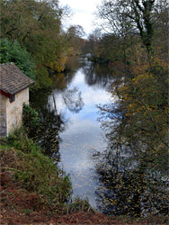
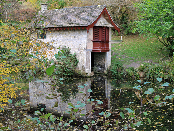
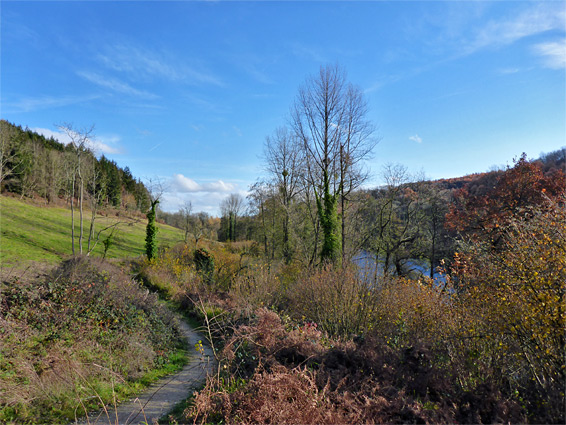
The two tracks converge near the uppermost of the artificial lakes, Brickkiln Pond, which is much reduced in size following collapse of its dam in the 1940s; it connects to the narrow Old Pond, which in turn links to Middle Pond, the largest, at a quarter of a mile long. The very small Honeywell Pond lies just uphill, mostly surrounded by trees. An intact boathouse overlooks the west end of Middle Pond, built in the early 1800s, with a single, upper floor room above a sheltered mooring enclosure. This structure is about half way along the valley, the eastern half of which is rather less visited. Various tracks continue, two along either edge of Middle Pond and others higher up the valley, also on both sides, these through extensive plantations of mature conifers. Below Middle Pond is Kennel Pond, named after stone kennels bordering a field to the south (partly ruined), while the final lake is Parkmill Pond, which contains a circular island, an important nesting site for herons. Water flows from Parkmill Pond down a spillway and thence towards Nailsworth, the suburbs of which can be seen not far downstream.