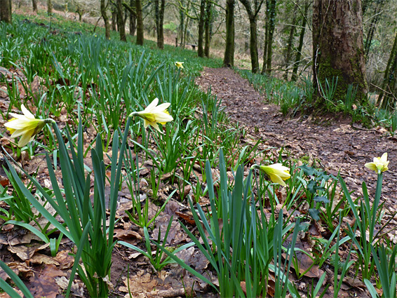
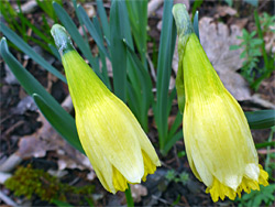
Margaret's Wood Nature Reserve is a small, rather hidden site in the steep-sided valley of White Brook, a western tributary of the River Wye, four miles south of Monmouth. Most of the valley slopes are forested, and within the reserve are a patch of ancient trees, established here for at least 400 years, plus a more sparsely wooded area where the ground is covered by grass, bluebells, and most notably, wild daffodils - this latter is a comparatively rare species, having greatly declined in the past hundred years after loss of habitat, and hybridisation with cultivated daffodils which are planted on many roadsides. The wild species is characterised by flowers that are smaller, and more obviously bicoloured compared with the cultivars, formed of six pale cream tepals and a yellow tubular corona, with fringed margins.
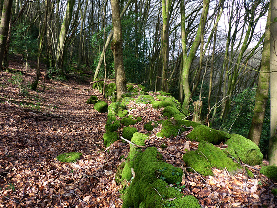
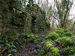
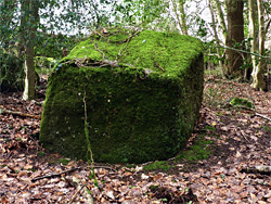
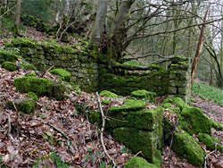
Also of interest in the five acre reserve are the ruins of two stone buildings, abandoned for at least a century, and some ancient stone walls, formerly marking field boundaries. The walls, the ruins and some of the tree trunks are covered in thick moss, as are many huge boulders scattered across the hillside, all of which are composed of coarse-grained conglomerate, from the brownstones member of the Old Red Sandstone formation.
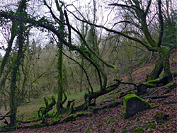
The trees are mostly beech and oak, together with holly, birch, yew and cherry, while the limited selection of wildflowers also includes wood anemone, wood sorrel, lesser celandine and hedge woundwort; the land is north-facing and steep, and the woodland canopy is tall, so the floor of the reserve does not receive much sunlight, especially once the trees are in leaf. The generally moist, cool conditions are also good for ferns and fungi.
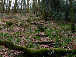
A narrow lane runs along the Whitebrook valley, linking the B4293 north of Trelleck with the A466 along the River Wye. The reserve entrance is not obvious, indicated only by a small sign at the edge of the woods; there is parking for a couple of vehicles on a verge a short distance east, and more spaces at the Whitebrook Inn, 300 feet further. From the entrance, a path leads up a slope to a faded Gwent Wildlife Trust information board then climbs more, through the daffodil area into the ancient woodland, where a series of steps aid the ascent. At the upper edge of the reserve the trail exits to a narrow track, below a secluded residence. In this corner of the reserve are walls that once enclosed two small fields, the stones now covered in thick moss and partly enveloped by trees, while another, longer wall crosses the middle of the reserve and links with the remains of a single room building. A larger ruin overlooks the road beside the entrance, though this is fenced off since the structure is deemed to be unstable.