Major river flowing through a deep, wooded valley, over three large waterfalls and several lesser cascades; explored by the Elidir Trail, running all along the west bank
The Elidir Trail visits three major waterfalls along the Afon Nedd Fechan (River Neath), plus another on the tributary of Afon Pyrddin, and is regarded as the second best waterfall hike in Brecon Beacons National Park, after the Four Falls Walk, a few miles east along the Mellte and Hepste rivers. The Neath flows through a wooded gorge, which although deep is never particularly narrow, and contains no great obstacles, allowing paths to follow nearly the whole length, from the south end at the village of Pontneddfechan, northwards for 4 miles, near the point where the river rises out of the trees to open ground in the foothills of Forest Fawr.
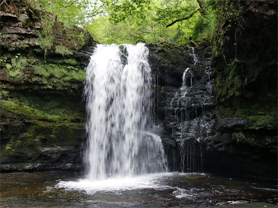
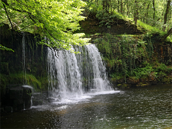
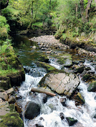
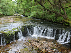
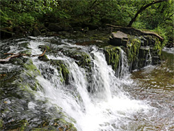
Most people just walk to the three waterfalls, however, a distance of 1.9 miles, or perhaps a third of a mile further to Pont Melin-fach, the only other place where the valley is accessible by road. The first falls, a little way after the Afon Pyrddin confluence, is Sgwd-y-Bedol, better known by the English name, Horseshoe Falls; this is just a few feet high though relatively wide, and quite spectacular when the river is in full flow. Not far beyond is the most spectacular, Sgwd Ddwli Isaf or Lower Gushing Falls, where the river drops about 30 feet into a briefly cliff-lined gorge, then in another quarter of a mile the trail arrives at Sgwd Ddwli Uchaf, Upper Gushing Falls, a broader, curtain-like waterfall above a large pool. There are numerous minor cascades in between, while beyond, the less-visited section of the Afon Nedd Fechan north of Pont Melin-fach also has pretty areas. The paths rise through some steeper sections but are mostly fairly level, well used and not difficult. Some parts are crossed by many roots, while others stay muddy for a long time after rainfall.
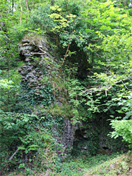
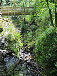
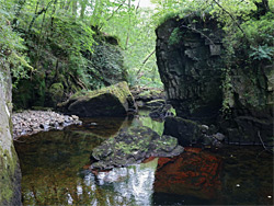
Parking for the Elidir Trail is in a small area beside the now closed Waterfall Centre, opposite the Angel Inn, just off the road through Pontneddfechan. The wide path, formerly a tramway, starts beside a wrought iron gate marked 'Waterfall Country, Bror Sgydau'. The first 0.7 miles are nearly level, and right beside the river, since this is along the old tramway, up to the point where this once crossed on a bridge, to some coal excavations on the east bank. Features on this initial stretch include an overhanging cliff where the path is briefly diverted, a deep cave-like alcove, the overgrown ruins of a 14th century corn mill, and a tree-lined field, sometimes used as grazing for a herd of sheep. After the bridge site, the path is just a little narrower and more undulating, passing a weir and reaching the Afon Pyrddin in another 0.3 miles. The main waterfall along this river (Sgwd Gwladus) is a few minutes walk upstream, reached by paths along both sides, linked by a footbridge at the confluence. The Elidir Trail continues north along the west side of the Nedd Fechan, past a second bridge which is used by a half mile path that heads back south along the opposite side of the river, to the old coal workings.
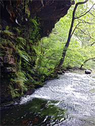
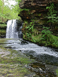
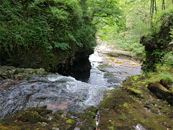
The main trail climbs through open, ferny woods, becoming quite far above the river, which is still generally in full view, flowing over several cascades. The ground levels out as the river continues to gain height, so the path eventually comes back down to the river bank, at an unnamed waterfall, continuing a short distance to Horseshoe Falls, opposite a pretty side-ravine crossed by another footbridge. During drier periods the river upstream is flanked by flat, exposed rocks enabling walking right beside the water, to the next waterfall, Sgwd Ddwli Isaf, visible in the distance, while in wetter times this can be reached by staying on the path, which starts to climb once more, then descending a short spur trail after a few hundred yards. Below the falls is a wide cascade, about six feet high, then an enclosed section between dark, overhanging, fern-covered sandstone cliffs and finally the waterfall itself, dropping into a shallow pool. Another brief diversion from the path, further upstream, allows the fall to be viewed from directly above.
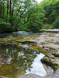
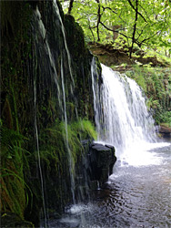
Above Sgwd Ddwli Isaf the valley sides are somewhat less steep, the woods more overgrown. The path ascends gently and comes beside the river again at the brink of Sgwd Ddwli Uchaf, next to a sizable flat, rocky area; the base of the falls can be reached by climbing down a short cliff on the west side, or via another side path that forks off a little way downstream. There are no more major falls beyond this point though the river does have a number of smaller cascades over the next 0.3 miles to Pont Melin-fach, where a minor road crosses, just upstream of a meadow, used as a picnic area. The river path resumes on the east side, across the road bridge - a generally narrower route through similarly dense woodland. There is a bendy, entrenched section after half a mile, and the valley stays relatively deep for two more miles, narrowing significantly towards the upper end, by which time the path has moved away.