There are many waterfalls in the narrow, wooded gorges that cut through the lower reaches of the Brecon Beacons, fed by the frequent, year-around rainfall. Four of the largest and prettiest may be viewed along a 5.2 mile, partial loop hike, the Four Falls Walk, near the tranquil village of Ystradfellte, towards the west side of the national park.
Three of the falls are along one river, the Mellte, while the fourth is on the Hepste, which joins from the east, and all are somewhat different in character. The approach is through flattish, forested land for about a mile, before the path descends quite gently to the first falls (Sgwd Clun Gwyn) then follows the rim of a deepening ravine to a junction with a more steeply descending spur path to the second and third (Sgwd y Pannwr and Sgwd Isaf Clun Gwyn), 250 feet below. The final waterfall (Sgwd yr Eira), not far beyond, is in a somewhat less deep ravine, after which the loop section of the hike is completed via another track through the pine forest. A little scrambling is needed to reach the best viewpoint of the third falls, but the others are relatively easy to access. The area around the two rivers, along with several other nearby drainages, is known as Waterfall Country owing to the abundant cascades, several dozen of which may be accessed by trail.
There are two possible start points for the Four Falls Walk, both accessed by a narrow country road that links Ystradfellte with the A4059. One is at Cwm Porth, right beside the River Mellte, which just downstream flows underground a short distance through the spectacular though generally inaccessible cave of Porth yr Ogof. Parking spaces are limited here, so for those just visiting the falls, the preferred start is 0.7 miles east at Gwaun Hepste, a bigger parking area, in a forest clearing.
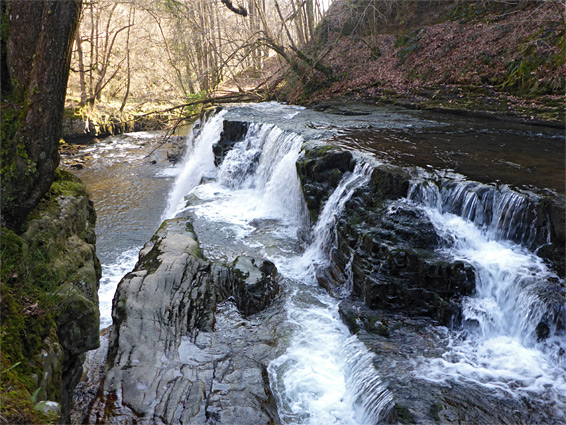
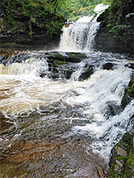
From the Gwaun Hepste carpark, the walk is due south along a forest track, passing a small quarry and two junctions with unsignposted tracks to the east, and reaching a third junction after 1.2 miles, as the land starts to descend, at the start of the loop section. The right (west) fork drops down more and reaches the River Mellte, at this point flowing through a relatively shallow gorge, but this depends steadily downstream to the south, initially by the first of the four falls - Sgwd Clun Gwyn, or Fall of the White Widow. The waters flow over a broad, flat sandstone slab tumbling about 40 feet, followed by several smaller cascades. Beyond here the main path runs south through lightly wooded terrain above the deepening canyon, across a few minor streams and on to a junction with the spur path, 2 miles from the start. An alternative route, quite well used though marked with several notices advising of its difficulty, also heads south staying closer to the river, along the base of several sections of jagged, dark-coloured cliffs, then descends quite steeply to the next waterfall downstream, Sgwd Isaf Clun Gwyn - see below.
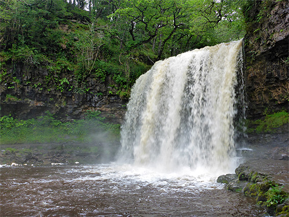
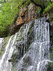
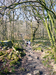
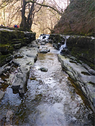
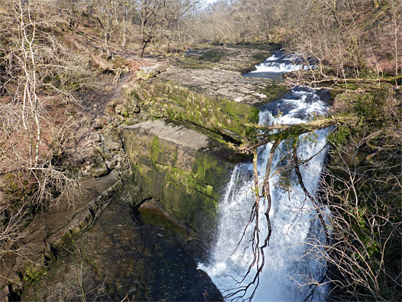
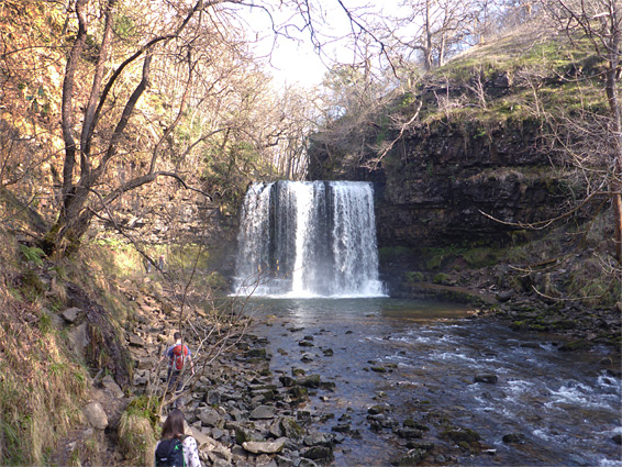
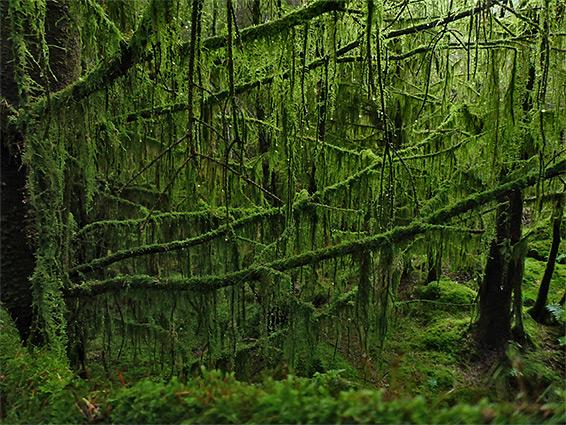
The spur path off the main route is steep, as by now the valley has deepened considerably; the route descends by 250 feet, heading back upstream, first to Sgwd y Pannwr (Fall of the Fuller) and then to Sgwd Isaf Clun Gwyn, Lower Fall of the White Meadow. The former has one main drop above which are small cascades into another channel where the water enters both from one side and from the end, while the latter, reached after a somewhat rougher section of the trail necessitating a little climbing, is more of a sequence of falls, separated by ledges and deep pools. From here the secondary path climbs further towards the first waterfall, Sgwd Clun Gwyn. Back at the junction on the valley rim, the main path soon curves round to the east, and another short spur descends to Sgwd yr Eira (Waterfall of Snow), along the River Hepste. This is a sheet fall; broad, evenly shaped and with an opening behind, which allows hikers to walk all the way to the far side. without getting unduly wet. Above here the main trail then leaves the river, heading north through the woods once more, and meets the initial path at the third junction. Along the way is a particularly evocative section of forest, a conifer plantation (west side of the path), where the trees are draped with copious amounts of hanging green moss. The River Hepste above the falls may be explored via a separate hike.