Cross-country walk up the Nant Cynafon valley, past many pools and waterfalls, to the summit of Waen Rydd and the central ridge of the Brecon Beacons, returning via the Wellington Bomber Memorial, the cliffs of Cwar y Gigfran and the ridge leading to Allt Lwyd
The Brecon Beacons offer many opportunities for cross-country hiking, visiting places just as scenic as the well-known areas but usually without any other people. Described here is one such route, starting on the road past Talybont Reservoir and following a stream, Nant Cynafon, uphill into the high country, to the flat-topped summit of Waen Rydd and finally to the main ridgeline of the Beacons, for grand views northwards across the River Usk valley.
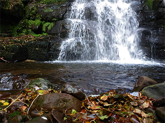
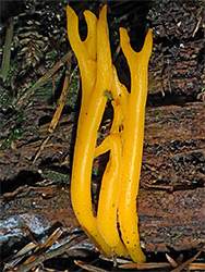
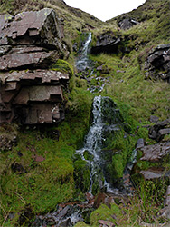
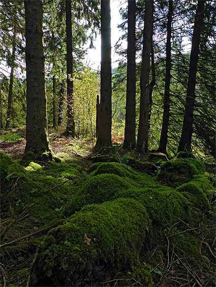
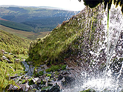
The first mile of the valley is enclosed by woodland, partly natural, deciduous trees but mostly conifers from a plantation, where the ground is thickly covered with moss and harbours many fungi species; eerie, atmospheric scenery. The stream carries a relatively large amount of water most of the year, and forms numerous pools and cascades plus several quite large waterfalls, hitherto unknown.
The scenery changes abruptly once beyond the woodland, to open moorland with expansive views, as the stream, accompanied by a few more cascades, continues right to the top of Waen Rydd, a peat plateau one mile across, the far side of which drops steeply down, part of the northern slopes of the Beacons.
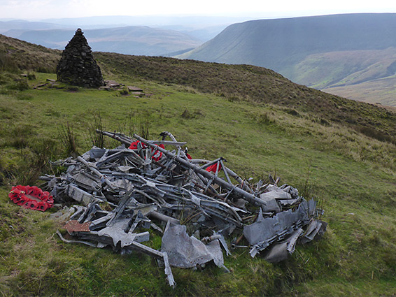
Another point of interest hereabouts is in the valley below the western edge of the summit plateau - a stone memorial to a crashed World War II Wellington bomber, still accompanied by the weathered aluminium remains of the plane itself, made even more evocative for the remote, isolated location.
There are several route options, including use of a forest track to bypass the lower Nant Cynafon gorge which may be difficult for some, but the approximate distance to the central ridgeline is a six mile round trip, gaining 1,720 feet.
The Nant Cynafon flows under Talybont Reservoir Road half a mile west of the upper end of the reservoir, at Abercynafon Farm, and the hike alongside the stream can begin from here, but a better place is 900 feet east in a layby, at the start of a path that climbs the hillside, running between woodland and a field. After 1,500 feet the path meets a forestry track which continues up the valley and later crosses the stream and turns back on the opposite side, all through an extensive conifer plantation (Talybont Forest). The pathway though resumes after 1,200 feet, descending from the track and fording the stream to the ruins of an ancient farmhouse, Cwm y Gelynen, seemingly abandoned for well over a century. This is the (little-visited) destination of the path from the main road and there are no other official walking routes nearby though the track through the plantation could be followed in either direction, for a total of six miles.
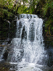
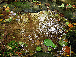
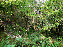
If walking directly up the Nant Cynafon, the stream may be reached by leaving the path quite near the start, crossing the adjacent field into the corridor of trees around the creek, and descending a slippery slope to the valley floor. The hike uphill is generally not too difficult, at least during times of low water levels but will be more challenging during rainy periods as then the required stream crossings are more problematic. The valley is only moderately overgrown and has just a few rocky areas that may necessitate a little scrambling. The lower portion of the stream flows down cascades and many pools, while higher up are three significant waterfalls, the tallest maybe 20 feet, all very pretty. Not far beyond the uppermost is a fence and then the ford along the path to Cwm y Gelynen, which ends a short distance beyond at the farmhouse ruin, a rectangle of low walls and the remains of a fireplace, set beneath shady trees and partly obscured with ivy. This place is approximately at the border between the natural woodland in the lower portion of the valley and conifers above, and both sides of the stream are bordered by atmospheric trees - well separated to the east, with a thick, green, mossy floor, more dense and dark to the west.
The next portion of the stream has no more large falls and is a bit more overgrown and rocky, less scenic, so walking is now easiest on benches above, to the west, and a quarter of a mile from the ruin, the trees are interrupted by the broad corridor of the forest road, beyond which is another short (700 feet) belt of woodland before the upper edge of the plantation and the start of moorland. The stream gains height steadily more steeply while remaining easy enough to follow, rising another 850 feet over half a mile to the edge of the Waen Rydd plateau. Towards the top are some narrower waterfalls and smaller pools, still quite pretty.
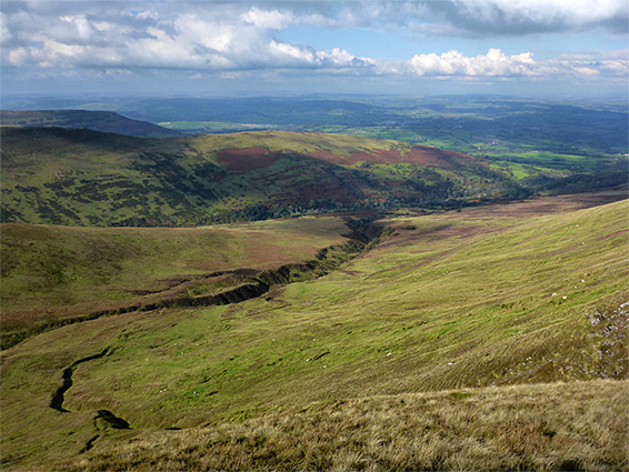
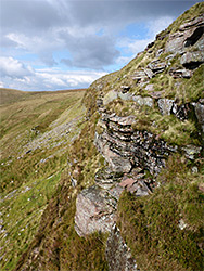
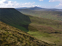
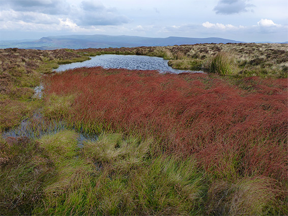
The Waen Rydd plateau is covered by thick, tussocky grass and extensive boggy patches plus many dark water pools lined by black peat deposits. Sheep paths criss-cross the grassland and one more well used route heads northwest and intersects a recognised path from the east which leads directly to the main Beacons ridgeline trail, from Fan y Big and Pen y Fan. The intersection, right on the brink of the steep northern slopes, has grand views over many square miles of central Wales. Also at this junction are two other paths, one heading southwest along the top of the cliffs of Craig Fan-las, later descending towards Nant Bwrefwr, the other entering the valley between here and the east edge of Waen Rydd. This latter path leads to the plane crash location, after descending a little down the valley then levelling out, traversing the slopes to the east and soon reaching the site, about 60 feet below the plateau at the foot of a line of low cliffs, Cwar y Gigfran. The accident occurred on 20th November 1944 and resulted in the deaths of all crew, six Canadians. The wreckage has been gathered into three main piles, one right next to the stone memorial, which is often visited, and poppy wreaths are placed here each year.
One way back from the plane crash site is to continue traversing at the same level for a while, past some photogenic rock formations below the cliffs, round a prominent ridge then descend towards Nant Cynafon, following this downstream. A slightly longer alternative route involves first climbing back to the plateau, towards the end of the line of cliffs, and walking along the rim, round the head of Nant Cynafon, now moving eastwards, to the point where the land narrows to a sloping ridge, and follow this downhill to the rounded summit of Allt Lwyd. The ridge affords the first views of lands to the east, not previously visible. The final stage is to walk southwest from the summit, down a consistently steep slope, initially grassy then into a recently-cleared section of the conifer plantation, and back to the forestry road, from where the parking area is 0.6 miles away, along this road then down the path.