Shallow, upland valley underlain by limestone, with mixed habitats of alkaline fens, fen meadows, marshy grassland and acidic grassland, towards the south edge of Brecon Beacons National Park
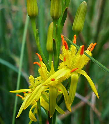
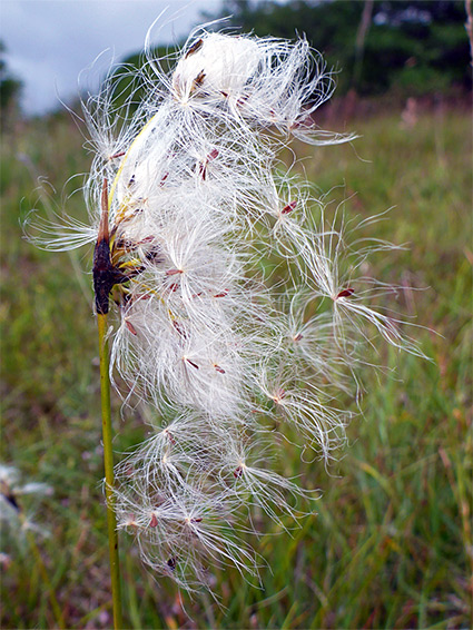
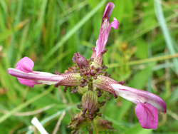
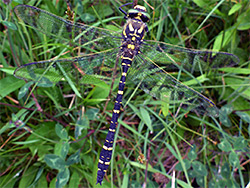
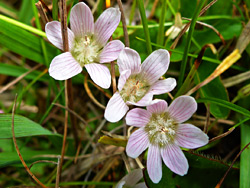
Near Penderyn along the south edge of Brecon Beacons National Park, Cwm Cadlan National Nature Reserve contains alkaline fens, molinia or fen meadows, other marshy grassland, and patches of the acidic grassland that is more typical of this part of Wales - an unusual mix of habitats, which sustains such rare plants as bog pimpernel, bog asphodel, marsh helleborine, marsh lousewort, globeflower, common butterwort and bogbean, together with a wide range of sedges, rushes and grasses. Sundews are also locally abundant, while other orchids found here are early marsh, fragrant, heath spotted and common spotted. Bogbean can bloom as early as March but in general the peak flowering times are in midsummer, from June to August. Two insects of particular note are the marsh fritillary butterfly and the demoiselle damselfly.
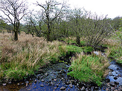
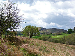
The site is mostly underlain by limestone and is relatively flat, occupying the floor of a wide, shallow valley between gently sloping land rising to extensive moorland to the north (Cefn Cadlan) and south (Mynydd-y-glog), so the place is naturally wet, due to lime-rich water seeping down from the hills in the form of springs and streams. Past agricultural modifications, principally construction of drainage ditches have led to a decline in the extent of the wetland habitats, and work is ongoing to restore the land to its original state.
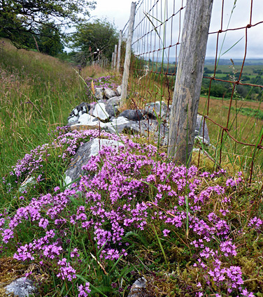
This reserve is not much publicised so is little visited. The land within the NNR extends for nearly a mile along the valley, and most is also within both the Cwm Cadlan SAC, and SSSI (Special Area of Conservation, and Site of Special Scientific Interest), which continue for over a mile further northeast.
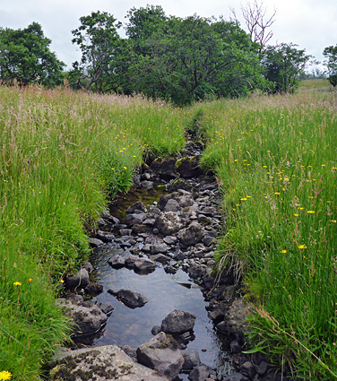
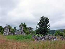
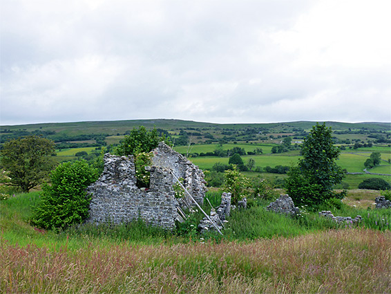
A stream, Nant Cadlan, runs through the valley, joined by a few tiny tributaries; all are lined by woodland, but away from the flowing water nearly all the site is treeless, mostly rough grassland with occasional rock piles, crossed by a few ancient field boundaries and also by several tracks and paths. The suggested walk is 0.6 miles, across the main stream and up the far side of the valley through gradually drier surroundings, to the picturesque ruin of a long abandoned farm (Cae'r-Arglwydd), and although the round trip takes less than an hour, a whole day could be spent exploring more extensively, and looking for unusual plants and insects.
The nature reserve is reached by the undesignated road linking Penderyn, along the A4059, with Llwyn-on Reservoir beside the A470, north of Merthyr Tydfil. The site is identified by a notice and a small layby for parking, just less than one mile northeast of the village. The entrance path follows an old vehicle track, past three gates then down through a belt of trees, between ancient mossy walls, to a footbridge across the stream. On the far side it climbs slightly across a field to a junction, where the eastern branch leads to the farm ruin, a relatively high location that gives the best overall views of the area, while the other branch follows the valley further downstream to the southwest. There appear not to be any other entry points into the reserve.
The rarest plants are concentrated in the alkaline fens, which cover about one sixth of the site; these are permanently wet areas, surrounding seeps and springs. The largest of the fens in the SSSI are east of the NNR further up the valley but there are several smaller areas beside the stream in the reserve, the closest to the path being just before the footbridge, on the east side. Surrounding the alkaline fens are larger areas of fen meadow - wet grassland, still calcareous through not directly fed by flowing water, and a good example of this is on the south side of the stream along the first half of the track to the ruined farm. Away from the paths it is relatively easy to walk cross-country in most areas of the reserve though some places are marshy and/or tufty, while some parts, close to the stream, are quite overgrown.