Four mile stretch of the north Somerset coast, with limestone cliffs and some pebble beaches, but mostly saltmarsh and grassy fields, followed by public paths part of the way
Location
Clevedon - starting near Clevedon Marine Lake; BS21 7TR
Walk
2 miles for the easily accessible section, approaching Kingston Pill, or 4 miles all the way to the River Yeo
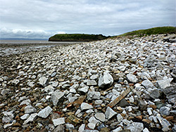
The five miles between Clevedon and Middle Hope is a rather neglected part of the north Somerset coastline since most is bordered by fields and saltmarsh, and so not particularly photogenic, though to the north, close to the town, are some pebble beaches and a band of limestone cliffs, up to 100 feet high, on top of which are woodland and a meadow.
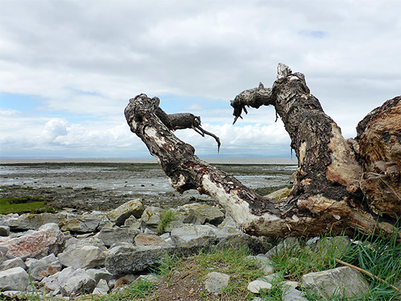
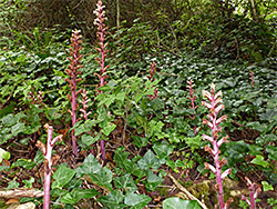
A path runs southwards above the cliffs and part of the way along the flats beyond, until blocked by a fence, at the edge of private land, though continuation is possible right at beach level as far as the mouth of the River Yeo, a wide, muddy watercourse that is not bridged for over a mile inland. This point is about one mile from Middle Hope, just before which is another uncrossable drainage, the River Banwell, surrounded by more muddy flats; rather inaccessible (and site of a sewage works) so very rarely visited, however the four miles between Clevedon and the River Yeo is scenic enough, especially the northern half, up to the fence. Wildflowers are quite varied, with one set on the on the limestone cliffs and grassland, and another on the salt marsh and estuarine margins.
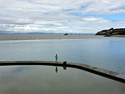
The walk starts at Salthouse Bay in Clevedon, beside Clevedon Marine Lake, a 3.7 acre, all-year swimming facility opened in 1929, containing 30,000 litres of seawater when full, and varying in depth from less than 1 metre to over 3. The lake adjoins a park, a restaurant and a paid parking area; free parking places can be found a short distance away on residential streets.
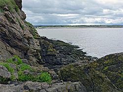
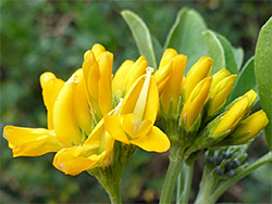
A path from the carpark at Salthouse Bay leads to Salthouse Point, a rocky spur overlooking the marine lake, then climbs through woodland, up to Church Hill, which forms the northern half of the limestone promontory. It passes another viewpoint (The Lookout), within a small stone structure, continues past St Andrews Church and crosses a sizeable meadow atop Wain's Hill, the southern half of the promontory. Steep cliffs and dense undergrowth make most of the seaward slopes inaccessible, the one exception being towards the south, when the ground is more open, and a short path descends towards sea level over rocky slopes, with a good range of calcareous plants including common centaury, sea campion, sea thrift and yellow-wort. It also has one very rare non-native plant, tree medick, found only in a few other places in the country. At low tide this area can be reached, with some effort, by walking at sea level from Salthouse Bay, over big slippery boulders below the dark-coloured cliffs. The intertidal zone is narrow since the land slopes down quite steeply and at high tide the waters cover the base of the cliffs.
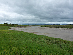
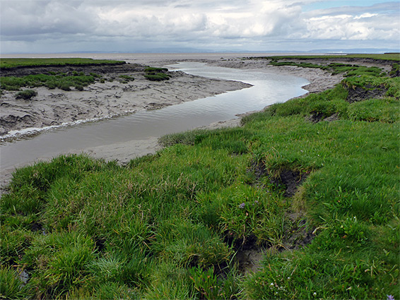
On the south side of Wain's Hill is a muddy bay (Clevedon Pill, also known as Small Harbour) lined by saltmarsh, where two rivers meet the sea; the Land Yeo and the Blind Yeo, this latter flowing down a constructed channel; both are constrained by sluice gates. A path descends from the hill, curves round the bay, crosses the Blind Yeo and temporarily leavies the shoreline, running between two sections of the local golf course before returning to the coast at Gullhouse Point, a low stony headland that links at low tide to another limestone outcrop, Blackstone Rocks. The rocks and the point, like the two hills, are part of a ridge of limestone that extends 7.5 miles northeast to Portishead, and in the other direction, re-emerges from the sea at Middle Hope.
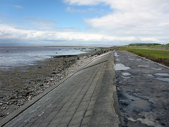
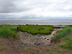
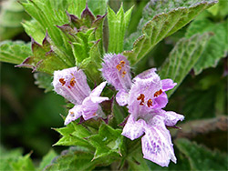
From Gullhouse Point to the River Yeo the shore is followed by two parallel embankments, one topped by a path, the other by a paved, vehicle-width track. Between the two is a band of grass and relatively dry saltmarsh, only occasionally flooded by the sea, while to the west is mix of mud, pebbles and wetter saltmarsh, where plants include greater sea-spurry, sea arrowgrass, sea-lavender, sea milkwort and sea plantain.
The coastal path extends 0.8 miles south of Gullhouse Point, up to the first of three fences across the embankments; half way along it meets the only connecting route to the coast, a short path from Lower Shore Road.
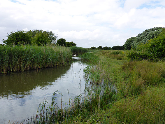
Not far south of the fence across the two embankments, another small stream winds seawards through a larger area of saltmarsh, flowing into the sea after another sluice gate, at Kingston Pill. The embankment tracks continue either side of a cattle field to a junction, with a private connecting route from Middle Lane, then beyond, the landscape remains similar for 1.2 miles to the River Yeo, alongside more fields managed by Avon Wildlife Trust, also used as cattle pasture. The embankments then bend inland and follow the river a little way, past a field that to the north adjoins Blake's Pools, a pair of shallow, reed-filled ponds, constructed relatively recently, that provide an important wildlife habitat, with over 100 bird species recorded here, the majority during the winter months. The grassy enclosure around the pools is also grazed by cows. The pools are a nature reserve though are only open to the public with a permit. Inland access is via an unsigned footpath across several fields starting at the end of the road to Wharf Farm. There are no other connecting routes inland from this section of the coast.