1 mile, from the parking area to the tip of the peninsula
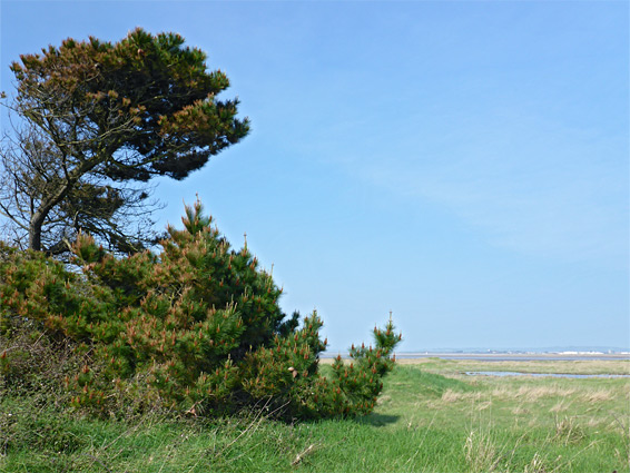
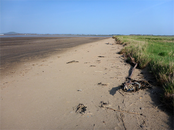
Stert Point, sometimes spelt Steart Point, is the tip of the Steart Peninsula, a promontory of low and often marshy land between the Bristol Channel and the River Parrett; the easternmost section of the Somerset coast, all lined by tidal mudflats apart from the furthest part which has a sandy beach and patches of shingle. The coastline hereabouts is not particularly scenic, due to the low relief and lack of any exposed rocks, but it is peaceful and quite atmospheric, since it is little visited and has a feeling of remoteness, lacking any development albeit within sight of Burnham-on-Sea on the far side of the river estuary.
All of Stert Point falls within Bridgewater Bay National Wildlife Refuge which extends 6 miles west encompassing the shoreline and some of the adjacent saltmarsh, but mostly just the tidal mudflats, which stretch up to 2 miles out to sea at the widest part. The refuge is an important centre for waterfowl and wading birds though apart from the point there is not much of scenic interest, for non-ornithologists.
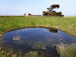
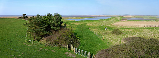
Similarly, a sizeable area south of the point, bordering the river, is protected as the Steart Marshes Wetland, another major bird habitat, though an artificial one, constructed in 2014 by deliberately breaching the sea wall to create marshes and flooded channels. Both preserves are equipped with viewing areas and hides, and there are two right at the point, one a 30 foot high wooden structure that gives the best view of the otherwise low and flat surroundings, the land at most twenty feet above sea level.
The narrow, dead-and road to Stert Point forks off the through route in the village of Otterhampton, north of Cannington, the road used by traffic to Hinkley Point. It crosses fields, passes a parking area beside the coast for the NWR then continues to another parking place, in Steart village; a gated enclosure beside a house. The road continues a little way and becomes a track then a path, leading to the furthest field, containing the tower hide. This place is also reachable by a path from the parking area, north a little way to the coast then northwest along the edge of the beach.
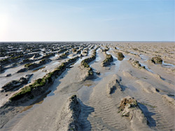
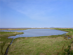
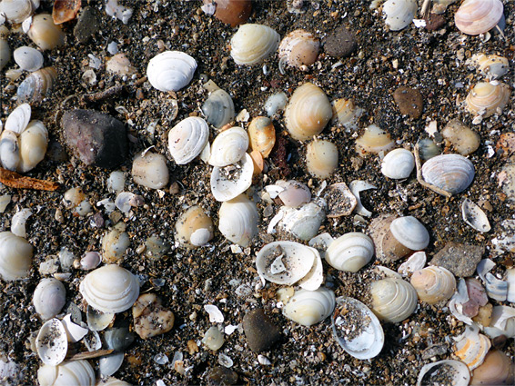
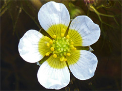
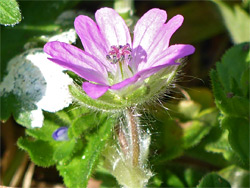
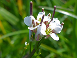
All of the coastline is similar for five miles between Stert Point and Hinkley Point - a very narrow band of sand along the high water mark, with grass above and featureless mud below; further west the first more photogenic, rocky section is near Lilstock. Only at the point is the mud partly replaced by a larger patch of sand, often covered in thousands of seashells, but generally free of litter. Inland, beyond the field with the bird hide, is a marshy area (known as Fenning Island) with several pools, one containing clear water, the others muddier, plus a few isolated pine trees, but mostly just long grass, crossed by several short paths. The field also contains a small pond, supporting a population of brackish water crowfoot (ranunculus baudotii), a white-flowered aquatic species. Other wildflowers in the area include rock sea-lavender, sea radish, hairy bittercress, tree mallow, Ray's knotgrass and yellow horned poppy.
Two thousand feet beyond the tip of the peninsula is Stert Island, a small patch of grass and mud barely above the high water mark, formed in 1798 when the River Parrett breached part of the peninsula. In earlier times the land was even more extensive, with the river continuing north some more and then west; evidence of this includes trunks from an ancient forest, exposed around low tide on the mudflats northeast of Hinkley Point.