Four mile stretch of the Somerset coast, including Kilve Pill and Quantock's Head, with layered cliffs above extensive, wave-cut terraces. Explorable via the coast path or walking beneath the cliffs
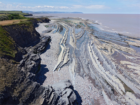
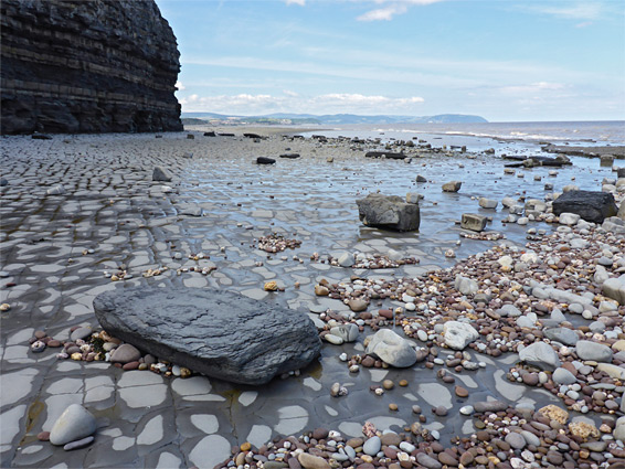
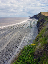
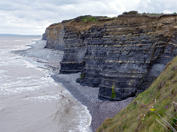
The four mile stretch of the Somerset coast between Lilstock and St Audrie's Bay is characterised by low, vertical cliffs of thin, mostly horizontal strata above wide, wave-cut terraces, either completely flat or formed of narrow, tilted ridges, created by erosion of slightly inclined layers. Some areas have sand, mud or pebbles, but most of the intertidal zone is bare rock.
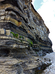
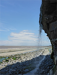
All the strata are from the late Triassic/early Jurassic blue lias formation, a mix of hard, bluish-grey limestone (the dominant component), and softer, brown or black shale, and this region forms the eastern half of the Blue Anchor to Lilstock Coast Site of Special Scientific Interest, designated (in 1971) on account of the excellent exposures, the high fossil content (especially ammonites), and the well-formed terraces. It also lies within Quantock Hills Area of Outstanding Natural Beauty. Similar rocks are found on the north side of the Bristol Channel along the Glamorgan Heritage Coast, for example at Ogmore-by-Sea, Dunraven Bay and Nash Point; these and other locations in Wales have generally higher cliffs and more varied formations, but the Somerset section is scenic enough, with pretty, curving strata across the terraces, plus a few shallow caves and at least one cliff-side waterfall.
The cliffs and terraces can be viewed from above by a generally little-used section of the coast path, or by walking at sea level; there are no difficult locations, and the beaches are only inaccessible for a few hours around high tide. The path runs mostly alongside fields, and the shoreline is in full view most of the time, just blocked occasionally by hedgerows.
The most popular access point to this section of the coastline is by a road north of Kilve, ending at a metered parking area. A short track heads north to a small lagoon at the edge of the beach, past a brick retort topped by an iron chimney, relic of a short-lived attempt to burn the oil-containing blue lias shale in the 1920s. Other nearby sections of the coast can be reached by longer paths between fields, including around East Quantoxhead and the vicinity of St Audrie's Bay, while the eastern end of the blue lias cliffs, near Lilstock, is also served by a dead-end road, northwest from the village, past a farm, to a free parking area.
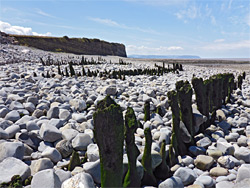
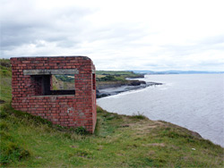
The coast path at the end of the road from Lilstock runs along flat land at the edge of a stony beach, though cliffs form a short distance west. In the other direction, the coast curves round a somewhat muddy, tree-lined bay that extends towards Hinkley Point. In the 19th century a short pier was built here (Lilstock Harbour) and a channel was dredged, allowing boats to land, though most was destroyed in 1900 by a storm, and now little remains; just a fragment of the pier foundations and a wide grassy ditch, formerly used for drainage. The westwards coast path soon passes the photogenic, sea weed-covered remains of several lines of wooden posts, then gradually climbs as the cliffs rise up. It passes an RAF observation station after half a mile, a red brick pill box after 1.5 miles, and arrives at Kilve beach after 2 miles; below all this stretch are dark grey cliffs, unstable and crumbling in places, above broad terraces, most formed of ledges angled perpendicular to the mainland.
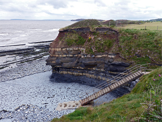
West of Kilve, the coast path climbs again to the top of slightly taller cliffs; along the edge of a field, round a little ravine, where the beach can be accessed via a flight of steps (the end of a connecting route from East Quantoxhead), and on to the highest area of land herabouts, Quantock's Head (168 feet). The trail stays right on the cliff edge for another mile, crosses a second small drainage that contains a flowing stream, and passes several viewpoints of a prominent, protruding cliff named Blue Ben, then moves away to avoid a larger ravine, Esson's Gully, which provides another access to the shoreline, down a path to the east end of St Audrie's Bay. This is a wide, partly sandy beach, overlooked on the far side by two caravan parks, and can also be reached by a three mile walk eastwards from Watchet.
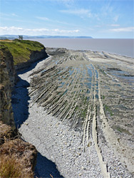
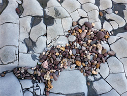
The shoreline walk back east from the end of Esson's Gully is initially over large, loose pebbles, up to the vicinity of the sheer cliffs of Blue Ben, when the floor becomes smooth, flat rock, in some places lacking any loose stones on top. Not far beyond is a waterfall emerging half way up the cliffs, the stream dropping about 15 feet, and, at low tide, sustaining a lengthy freshwater channel, flowing diagonally across the beach, held between two parallel ridges. The cliffs rise gradually higher up to Quantock's Head then recede slightly as Kilve approaches. The surroundings are little-changing, with layered cliffs, bands of whitish pebbles beneath, and terraces crossed by straight or curving ridges, harbouring many pools at low tide. Beyond Kilve the terraces slope seawards at a greater angle so the intertidal zone is narrower, but they become more level in the vicinity of Lilstock, and also more covered by pebbles.