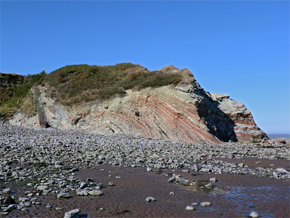
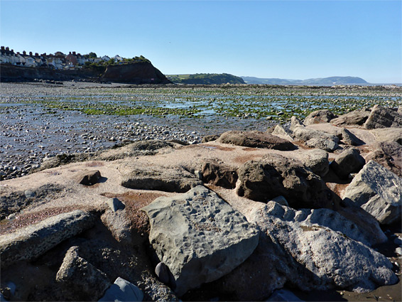
The three mile section of the coast from Watchet eastwards to St Audrie's Bay is similar to the majority of the north Somerset shoreline, characterised by mostly pebble or mud beaches backed by relatively low cliffs of thin-layered sedimentary rocks, though this region is notable for the variety of exposed strata, spanning the Jurassic/Triassic boundary. The majority of the rocks are greyish limestone and shale from the blue lias group, while those at centre of this stretch are reddish mudstone and sandstone.
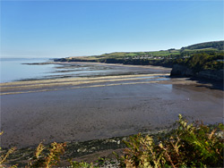
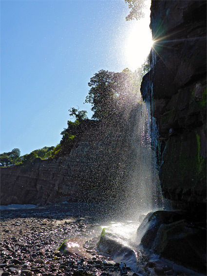
Immediately east of Watchet, the coast forms a small, red-walled headland then curves inwards to the broad sweep of Helwell Bay, followed by a lengthy straight leading to a smaller bay, and another headland, with an unusual waterfall just beyond, where a minor stream drops vertically by 70 feet over a mossy cliff. Ahead is the larger St Audrie's Bay, which extends to another vertical-walled promontory named Blue Ben, described in the next segment, St Audrie's Bay to Lilstock.
The three miles east of Watchet is also unusual for the lack of an inland coast path, since three sections of the adjoining land are privately owned, occupied by holiday parks, so most of the official coastal walk is directly along the beach. The route cuts inland only around the westerly park (Doniford Bay), but walking is still easy enough on the remainder as there are no obstructions on the beaches, and all areas can be accessed except around high tide.
There is no public road to the coast around St Audrie's Bay, and the next place eastwards for vehicular access is at Kilve, so the walk has to begin at Watchet, parking either somewhere in the town centre or, perhaps the best place, at a small, free area at the end of an unmarked lane off Doniford Road, past the local football club and just after a bridge over the West Somerset Railway. The road, now private, continues to a row of holiday chalets.
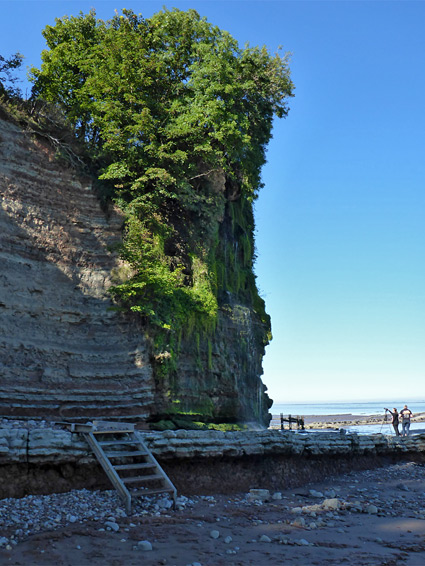
The car park lies along the route of the coast path - to the west this runs over a grassy bluff to Watchet Harbour, while to the east it heads across a field to a narrow promontory and descends a flight of steps to the edge of Helwell Bay. A short but interesting diversion is to walk westwards along the base of the bluffs, which are formed of alternating red and green layers of Mercia mudstone; a small patch of such rocks, exposed by faulting, surrounded by the blue lias. There are various eroded formations, and a short pebble beach, before the cliffs fall away and merge with the concrete pier forming the east wall of the harbour. At low tide the waters recede sufficiently to allow walking past the harbour mouth to the mud and rocks of Warren Bay on the far side.
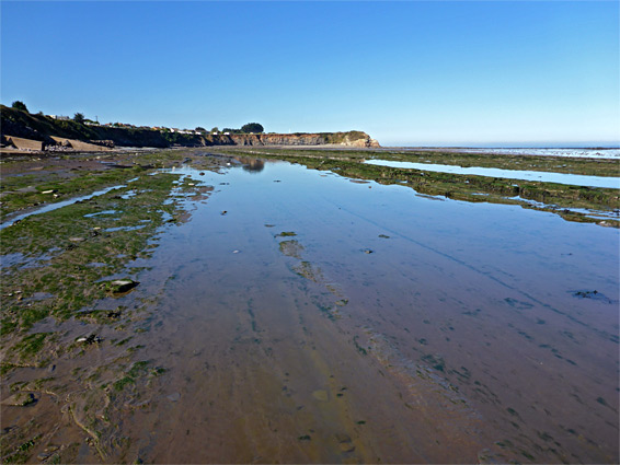
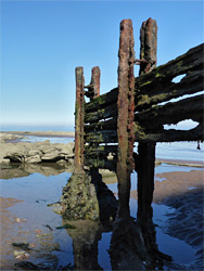
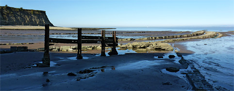
East of the promontory, the base of the cliffs of Helwell Bay is lined by pebbles, which give way after a short distance seawards to extensive, wave-cut terraces of inclined lias strata, up to a third of a mile across at low tide. The cliffs gradually lessen further east, becoming just a few feet high, and are replaced by low pebble banks, the boundary being a stream, just before the Doniford Bay holiday park, which extends for nearly half a mile along a generally uninteresting section of the coast. Cliffs rise again on the far side, curving round a minor headland to a narrower bay of pebbles and sand, a place accessed by a steep path, the only other inland route to this section of the coast. The bay was in Victorian times protected by short breakwaters at either side, and while most of the fabric is long gone, some iron and stone relics do survive.
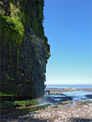
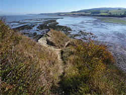
Beyond the bay is the waterfall, seemingly a natural feature, where a tiny stream drops by about 70 feet down a mudstone cliff, lined with moss and other bright green vegetation. This location lies close to the boundary of the blue lias formation; the greyish terraces and parallel ridges across the beach are largely replaced by red sand and mud, below red cliffs which extend most of the way across St Audrie's Bay. These rocks are only exposed in a relatively narrow band, however, and the lias still occupies the lower part of the inter-tidal zone. About half way along the bay is a flight of steps up to the St Audrie's holiday park, for guest use only, soon followed by another, smaller waterfall, at the lower end of Perry Gully. The coast path resumes at the far side of the bay, shortly before Blue Ben, by climbing another little valley (Esson's Gully) then staying on top of the cliffs, and intersecting the road from Kilve after 1.8 miles.
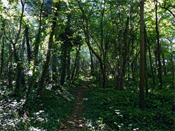
The one inland section of the coast path between St Audrie's Bay and Watchet leaves via the steps just west of the waterfall, climbing through a patch of woodland, briefly along the road to the Home Farm Holiday Centre, then into woods again for a few hundred feet before emerging to a field. It follows the north edge of the field, right at the brink of the cliffs, then cuts inland to bypass (most of) Doniford Bay Holiday Park. After here the route follows part of the access road, crosses another field, runs along Dunford Road a short distance and down a short lane to a small car park, where it returns to the beach, 0.6 miles before the steps at Helwell Bay.