Little-visited, four-mile section of the Glamorgan Heritage Coast, with layered, vertical cliffs of blue lias above extensive wave-cut terraces; also bays, beaches and sea caves
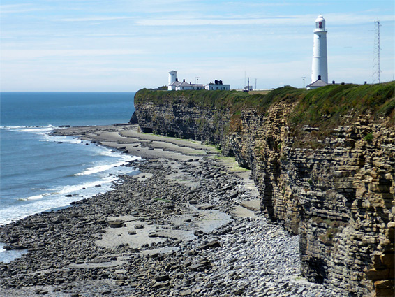
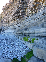
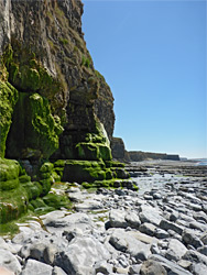
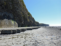
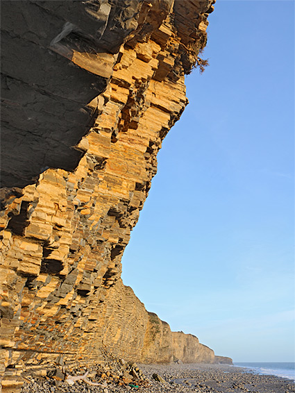
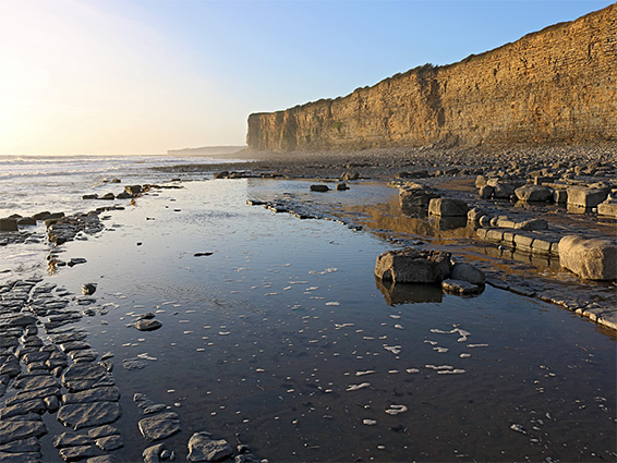
The four mile section of the Vale of Glamorgan shoreline from Nash Point in the west to Stout Bay in the east is part of the Glamorgan Heritage Coast, characterised by sand or pebble beaches, flat, wave-cut terraces and vertical cliffs of horizontal, thin-layered strata. In this region all the rocks are from the blue lias formation - mostly grey blue limestone, mixed with narrower beds of yellow-brown shale, and the cliffs range in height from 20 to 150 feet, with the individual strata ranging in thickness from several inches to a few feet.
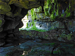
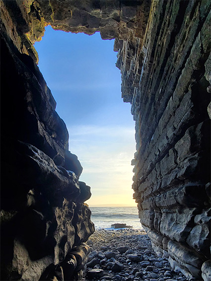
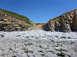
In some places the cliffs are eroded at sea level to form short caves, and in a few locations they are cut by small drainages, creating low valleys, but for most of they way they are sheer and continuous. The flat land beneath is composed either of boulders or bare rock, in some locations smooth and level for several hundred feet. There are just a few sandy patches, plus a larger collection of jumbled rocks around the mouth of Cwm Col-Hugh (Llantwit Major), the largest of the shallow valleys, which provides one of the two main access points. The other is at Nash Point, a narrow promontory beside the mouth of another minor valley.
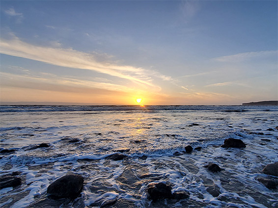
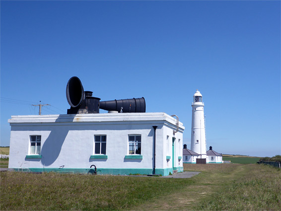
The shoreline can be seen from above via the coast path, or close-up from below by walking over the terraces and boulders, which are passible for several hours around low tide. Also of note are two lighthouses and a rare surviving example of a fog horn, on top of the cliffs just east of Nash Point. The cliffs and bluffs support a good range of wildflowers, mostly common species, and away from the point and the beach at Cwm Col-Hugh, the area is rarely explored. The round-trip distance is 8 miles though this can be shortened, via any of at least five places where the beach is reachable from the coast path. Walking along the shoreline is generally easy, due to the lengthy stretches of flat terraces, often lacking any covering borders, though in other locations the area below the cliffs is strewn with loose rocks, sometimes covered with slippery seaweed.
Parking at Cwm Col-Hugh, one mile south of Llantwit Major, requires payment, but it appears to be free at Nash Point, despite a sign advising of a charge, along the narrow approach road from Marcross. Here, parking is either beside the road or on an adjacent grassy flat, extending right to the cliff edge. The road continues a short distance to the lighthouse complex, built between 1831 and 1832; one large and one small tower, plus the fog horn installation and several other buildings, all painted white. The main light is still in operation, now (like all UK lighthouses) unstaffed, and is open to visitors three days a week.
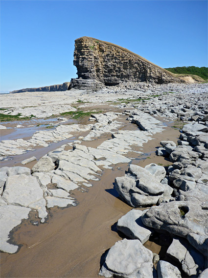
The beach at Nash Point is reached by a short path that descends into the grassy lower end of the adjacent valley (Cwm Marcross), then curves back towards the sea. A small stream flows, emerging upstream from a patch of woods, and soon dispersing in the pebble beach at the valley mouth. Nash Point rises above the end of the valley, on the west side; a hundred foot-high promontory of grey limestone, below which are flat terraces of slightly inclined layers, 600 feet wide at low tide. To the northwest, the coast is nearly straight for the next three miles, to Cwm Mawr and Witches Point near Dunraven Bay, while in the other direction, after a second minor point, the land bends round to the east and the cliffs become similarly sheer, straight and unbroken. The tops of the two lighthouses can be seen, above the cliffs, while ahead are more broad, flat terraces, largely lacking any loose rocks on top. A few seeps emerge at the base of the cliffs, lined by bright green algae and seaweed, plus at least one cave. After a while, a thin band of pebbles forms at the base of the cliffs though further south the intertidal zone still contains only the flat rocks.
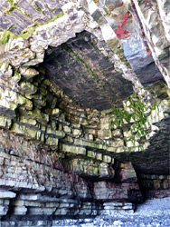
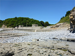
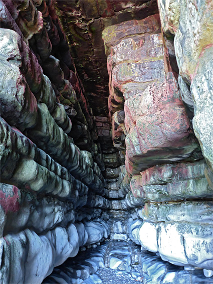
The next landmark is St Donat's Bay, where the low tide reveals some sandy patches, between the rocks and pebbles. The beach rises to an embankment, walkway and turretted wall, formerly part of a cavalry barracks, now owned by an educational establishment, UWC Atlantic College. The main college site is within St Donat's Castle, a quarter of a mile inland; some parts date from the early 1300s. Beyond the bay, the sheer cliffs resume, again rising above a mix of white pebbles and flat grey terraces. A small inlet shelters a row of steps (Lewis Thomas's Stair) connecting with the coast path above, then, after some particularly flat exposures, a small cavern named Reynard's Cave comes into view, its walls and ceiling stained deep red.
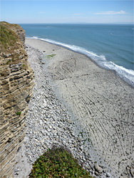
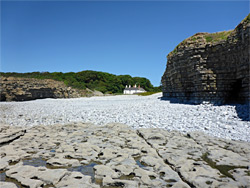
Round the next little promontory, the cliffs recede once more at Tresilian Bay, filled with larger pebbles, and overlooked by a secluded, white-painted residence (Tresilian House) just inland. On the far side, the cliffs are somewhat less high, and in one location (Dimhole), they slope down to allow another connection with the coast path. The low water mark moves steadily further from the mainland to a maximum distance of 1,500 feet opposite the end of Cwm Col-Hugh, the most popular location on this section of the coast owing to the easy access from Llantwit Major. The beach has a cafe and a large parking area, though the surroundings are not so scenic, as there is only a small area of sand; instead most of the beach is composed of jumbled rocks, partly covered in green seaweed, and muddy.
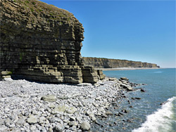
The eastwards section of the coast is similar in appearance to that before except that the strata eroded to form the terraces are somewhat inclined, resulting in a succession of low, parallel ridges between the flatter rocks, initially straight then curving, by up to 270 degrees in one location. There is one more small promontory (Pigeon Point), followed by the larger, double projection of Stout Point, which is passible for just a couple of hours around the lowest tides, and this leads to the next lengthy section of cliffs with no access from above. The shallow inlet just beyond is Stout Bay. The flat rocks around Stout Point are quite pretty, and conceal another large cave.
If returning, or approaching, via the coast path, the nearest access point is 600 feet northwest of Stout Point at New Way Stair, a stepped part of the cliffs which here are only around 40 feet high, on the west side of a small inlet. The route from here to Nash Point is mostly beside hedges along the edge of fields, with the sea in view about half the time. The walk starts with a lengthy field section, followed by a couple of wooded patches (one containing ditches from an ancient castle) and a short descent to Cwm Col-Hugh. The next stretch is along a narrow belt of undeveloped land, passing a World War II pill box at one point, then down across Tresilian Bay. The 0.8 miles to St Donat's Bay is initially beside a field, then through a larger patch of trees, while the final stretch passes a longer field and finally arrives at the lighthouse installation, at the end of the road from Nash Point.