Pewsey Downs is one of seven National Nature Reserves in Wiltshire, and like four of the others, contains chalk hills, steep slopes and dry valleys, part of the North Wessex Downs Area of Outstanding Natural Beauty. The reserve lies along the south edge of a major escarpment, stretching over 15 miles, from the vicinity of Devizes eastwards towards the Savernake Forest near Marlborough, and the protected area is also part of a Site of Special Scientific Interest (SSSI), because of its great range of chalk grassland plants, and the associated butterflies (28 species).
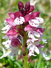
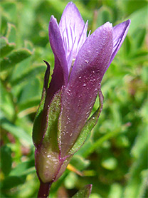
The rarest wildflowers are early gentian, burnt-tip orchid, meadow saxifrage, frog orchid, knapweed broomrape, tuberous thistle, field fleawort and bastard toadflax. Outside the reserve, the SSSI also contains a small area of ancient ash/maple woodland, which has a separate selection of uncommon plants. Slightly different vegetation is found in the flatter areas on top of the escarpment, as here the soils are neutral to acidic, with clay and flints, in contrast to the calcareous grassland on the south-facing slopes that makes up the majority of the reserve.
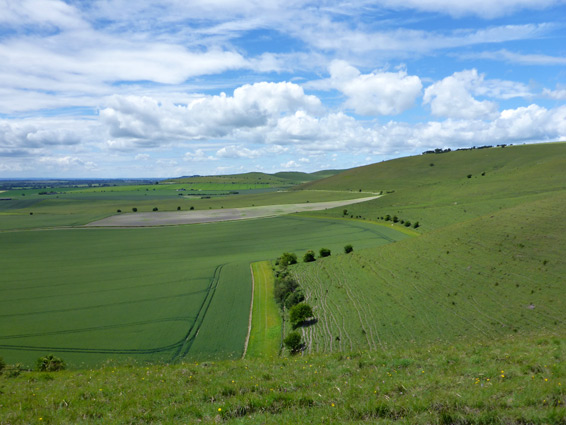
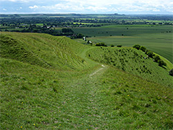
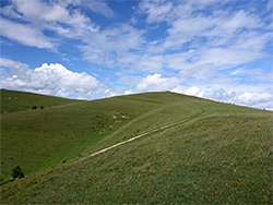
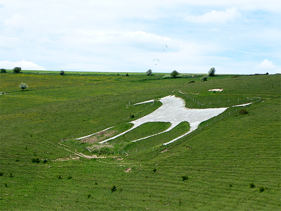
The nature reserve is accessed from a road across the slopes, and is crossed by several paths, the main route running east-west across the high ground. Although quite steep, the majority of the slopes can be explored by off-trail walking. The reserve also contains several ancient earthworks, most prominent being a Neolithic camp and a long barrow (burial mound), plus the figure of a white horse that was created at the start of the 19th century, the second-largest such carving in the county. Views to the south are very extensive, across the flat lands of the Vale of Pewsey towards the distant Salisbury Plain.
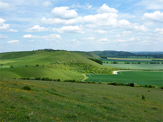
The (free) Pewsey Downs car park is located along the road between Marlborough and Woodborough, just north of the village of Alton Barnes. Most of the reserve lies to the west including the best wildflower locations, while the SSSI extends further, equally on both sides, in a broad band over 5 miles in length. The westwards path from the car park crosses a field and enters the reserve from the north; ahead is Walker's Hill, a typically low, rounded chalk summit, on top of which is Adam's Grave, a long barrow from around 3000 BC, consisting of a burial mound over 200 feet long, with ditches at either side. The grassland to the south is the best wildflower site, including the burnt-tip orchid and early gentian. The flowers grow most densely along ancient earthworks, including a ditch and embankment near the summit, and the course of a Roman Road (Icknield Way) a little further south. West of Walker's Hill, the escarpment bends to the north then straightens again to Milk Hill (the highest point in Wiltshire, and a popular location for hang-gliding), the summit of which is crossed by an ancient ditch. The Alton Barnes White Horse is situated between the two hills - a figure 160 by 180 feet in size, constructed by a local farmer in 1812. Past Milk Hill, the slope curves northwards again, round a larger valley, and on to the elongated Tan Hill, crossed by a track that marks the far edge of the nature reserve, though the SSSI continues another mile, to include another summit (Clifford's Hill) and Rybury Camp, a hillfort.
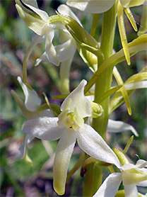
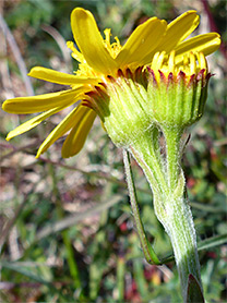
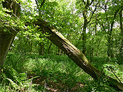
The path east from the car park leads first to Knap Hill, also the site of a Neolithic camp; ditches and embankments define an oval-shaped enclosure around 600 feet across. On the eastern bank is a colony of frog orchids, while also reported from this location is field fleawort. Although the hill marks the east boundary of the National Nature Reserve, the SSSI continues for 2 miles, along a straight section of the escarpment below Golden Ball Hill, then round a basin south of Draycott Hill and on to Gopher Wood, the remnant ash/maple woodland, where notable plants include herb paris, common toothwort, green hellebore and common Solomon's seal. The wood is quite overgrown, and is crossed by just one path, towards its east edge. Beyond, the furthest section of the SSSI encompasses part of Huish Hill, another steep, short-grass slope, with a little more scrub cover.