Nant Tarthwyni is a partly wooded valley containing a stream with pools and cascades, and can be used as a hiking route to the summit of Waen Rydd, one of the central peaks of the Brecon Beacons
Management
Brecon Beacons National Park
Location
Along the road past Talybont Reservoir; LD3 7YT
Walk
Around 5 miles round trip; 1,830 feet elevation gain
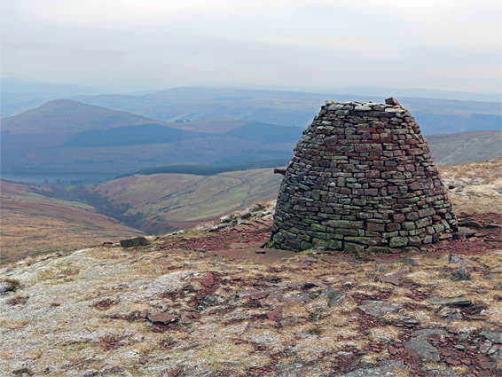
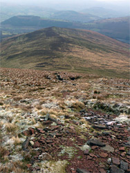
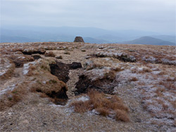
Waen Rydd is the easternmost peak of the central Brecon Beacons, 400 feet lower than the tallest (Pen y Fan) but still towering far above the neighbouring valleys, of the River Usk to the north and Talybont to the east. Like many mountains in the Beacons, the summit is rather flat and the actual highpoint is not well defined - the peak is more of a narrow plateau, about half a mile across, and its eastern edge is marked by a huge cairn named Carn Pica, in existence since at least the 19th century.
The peak can be reached by four main paths, the shorter two starting at Blaen y Glyn to the south (2.6 miles) or Talybont Reservoir in the east (2.4 miles). Both climb one of the ten ridges that radiate outwards from the high ground, in between which are broad valleys, usually partly wooded towards the lower reaches, and containing streams that form cascades and pools. The hike described here is up one such valley, of the stream named Nant Tarthwyni, returning via the path from the reservoir, a round trip of 5 miles, the first half of which is cross-country, off-trail.
The stream (Nant Tarthwyni) from the valley flows under the road half a mile south of the dam forming Talybont Reservoir. Vehicles can be left right beside the road bridge, on a sometimes muddy area in front of a gate, or a little further south at a more official parking area. The gate marks the start of a farm track that heads north a short distance then links with the ridgeline path to the Waen Rydd summit, a route that can also be joined by a shorter track starting beside the dam, and it also forms part of one variant of the loop hike, up the valley and down the ridge, though a lesser path (described below) provides a shortcut.
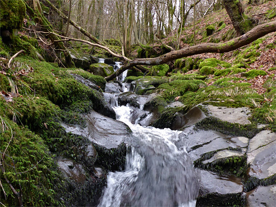
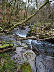
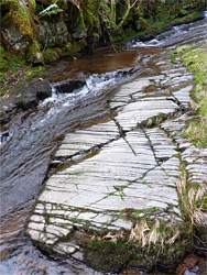
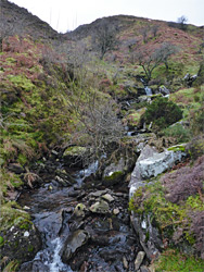
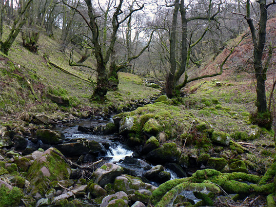
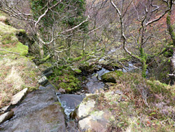
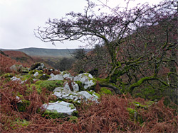
The roadside track starts right beside the stream, climbing steeply at first, then soon veering away northwards. The stream flows through a valley that is fairly steep-sided though not particularly enclosed, so walking alongside is relatively easy, sometimes jumping over to the opposite bank. The waters flow over cascades and small falls, through some deep pools, and are crossed by quite a few old branches and fallen or leaning trees. In places the creek is bordered by flat benches, spilt by many parallel, closely spaced fissures. The densely wooded corridor extends about one mile, approximately up to a fence marking the boundary of open access land - around here the valley sides become noticeably less steep, and the trees more scattered. The gradient steepens somewhat and the stream, though rather smaller, still creates some pretty cascades.
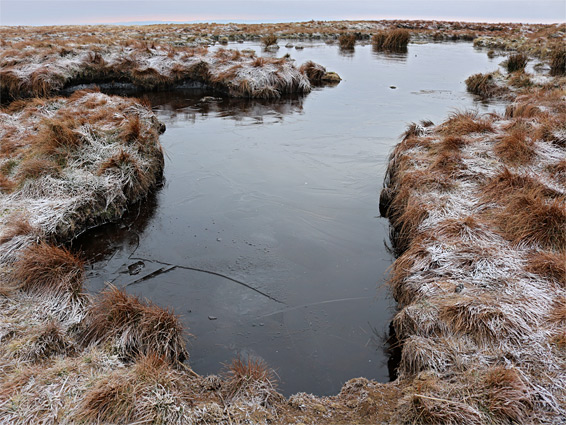
Steep slopes come fully into view ahead, enclosing the valley on three sides. The creek forks, the right branch carrying slightly more water, and this leads up to a small waterfall over a mossy cliff, above which the ravine is much shallower and the waters gradually fade away. The land is now completely treeless, covered only by grass and bracken, allowing a straightforward walk northwestwards, cross-country, up to the ridge that extends east from the Waen Rydd summit, and an intersection with the path. Turning left (west), this steepens as it rises to the summit plateau, at the edge of which is the great cairn of Carn Pica, recently damaged and only roughly repaired. The views are very extensive, to the north, east and south, while the westwards landscape is revealed after a short walk further over the plateau, which is marked with a few dark water pools. On the far of the peak, the path reaches a four-way junction, where the northwards and southwards paths descend, while the continuation links with the higher summits, and eventually to Pen y Fan.
The return route is back down the path below Carn Pica, staying on the trail as it follows the crest of the ridge north of the Nant Tarthwyni valley, descending in a series of short, steeper parts separated by longer, more level stretches. The path eventually links with the track to the parking area, though a shorter way back is to leave this towards the lower end of the ridge, traversing some steep ground before meeting a lesser track that descends into the lower end of the valley, joining the other route very close to the reservoir road.