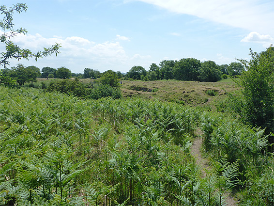
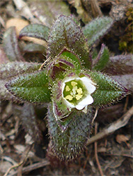
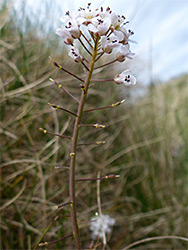
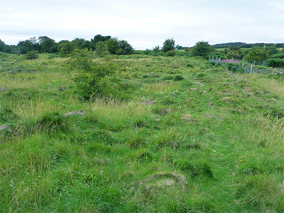
GB Gruffy is one of nearly 20 nature reserves in the Mendip Hills of north Somerset, though not amongst the most scenic, comprising a rectangular patch of rough grassland on fairly flat terrain on the south side of Black Down, without any great views. The northern half has damp, neutral soils, underlain by mudstone of the Avon Group, in contrast to the southern section which is acidic, calcareous and drier, above limestone from the Black Rock formation, and the wildflowers here are more varied, including three rare species, dwarf mouse-ear, Alpine pennycress and spring sandwort. These last two are generally restricted to spoil heaps from old lead mines - this region was mined for lead between the 16th and 18th centuries and most of the land in the southern section is uneven, dotted with pits and mounds, evidence of the past excavations.
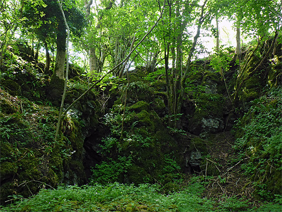
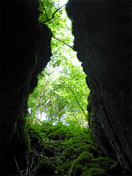
Gruffy is a local term for such rough, uneven terrain, while the other part of the reserve's name, GB, references GB Cave, one of the largest caves in the Mendips, entrance to which is just within the west edge. This in turn is named after FJ Goddard and CC Barker, members of the University of Bristol Spelaeological Society, who discovered it in 1939. There are also two large swallets (sinkholes) in the reserve, where ancient streams once flowed underground.
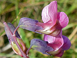
The reserve is reached by the road between Charterhouse and Shipham - on the south side, opposite another Somerset Wildlife Trust reserve, Lots Grassland; there is space for several vehicles at the entrance gate. The grassland slopes gently down from north to south, and a small (seasonal) stream flows through the northern part of the reserve, disappearing below ground once it reaches the limestone section, and lined by a few species of riparian plants such as lesser spearwort and lesser water-plantain. A 0.4 mile path runs down each side of the northern part and crosses some of the gruffy land, though it is easy to walk anywhere. A fence divides the two sections, partly to keep the sheep and Exmoor ponies, who are used to control growth of scrub, away from the gruffy portion, which is unsuitable for grazing. Tyning Farm Swallet, fenced-off for safety is situated just south of the end of the stream, while Great Swallet is right at the southern edge, ringed by trees. Entrance to GB Cave is via a locked gate; access is only by arrangement with the Charterhouse Caving Club, as is the case for Charterhouse Cave, another major system, the opening of which is towards the east side of the enclosure. Both the cave and other holes provide refuges for lesser horseshoe bats, easily spotted around dusk. These reserve also contains two badger sets.