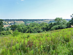
The Blackdown Hills are a relatively minor upland area, lacking any moorland or prominent peaks, and are formed mainly of sandstone (the upper greensand formation) along with small patches of calcareous rocks, principally chert and chalk. About one third is in (south) Somerset, the remainder in Devon, and the scenic qualities of the landscape were recognised in 1991 after designation as an Area of Outstanding Natural Beauty, encompassing an approximately circular region around 12 miles across.
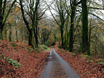
The hills are crossed by only one major road, the A303, and contain no large towns, the nearest major settlements being Taunton to the north, Honiton to the south and Chard to the east. The high point is 1,033 foot Staple Hill in Somerset, near which the land is generally at its most impressive, becoming gradually lower and more gentle to the south. Most of the roads through the hills are narrow and winding, often lined by ancient hedgebanks.
There are no significant areas of unfenced land in the Blackdown Hills, instead nearly all is enclosed by fields, used for agriculture and cattle grazing, the main exception being the northern slopes, which are thickly wooded. Three river valleys wind through the hills, largest that of the River Culm to the northwest. The others are the River Otter, which rises near Staple Hill and flows south towards Budleigh Salterton, and the River Yarty, a tributary of the River Axe.
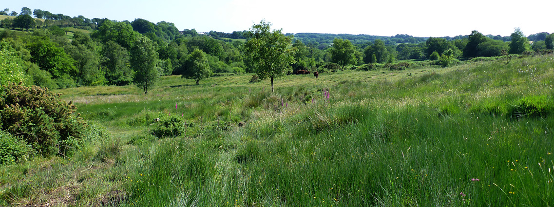
Within the Blackdown Hills AONB are 16 Sites of Special Scientific Interest, mostly bogs, ancient woodland and floral grassland, while other habitats include heath, marshy grassland, carr woods and conifer plantations. Most of the SSSIs are also nature reserves, of which the hills contain 14.
The hills are crossed by only one major road, the A303, and contain no large towns, the nearest major settlements being Taunton to the north, Honiton to the south and Chard to the east. The high point is 1,033 foot Staple Hill in Somerset, near which the land is generally at its most impressive, becoming gradually lower and more gentle to the south. Most of the roads through the hills are narrow and winding, often lined by ancient hedgebanks.
There are no significant areas of unfenced land in the Blackdown Hills, instead nearly all is enclosed by fields, used for agriculture and cattle grazing, the main exception being the northern slopes, which are thickly wooded. Three river valleys wind through the hills, largest that of the River Culm to the northwest. The others are the River Otter, which rises near Staple Hill and flows south towards Budleigh Salterton, and the River Yarty, a tributary of the River Axe.
Within the Blackdown Hills AONB are 16 Sites of Special Scientific Interest, mostly bogs, ancient woodland and floral grassland, while other habitats include heath, marshy grassland, carr woods and conifer plantations. Most of the SSSIs are also nature reserves, of which the hills contain 14.
Nature Reserves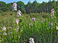 Two tree-lined fields containing a spring-line mire, the waters from which flow into the River Culm Rating: ★★★★★ |
 Mature oak/beech woodland on steeply-sloping ground Rating: ★★★★★ |
 Steeply-sloping, sometimes boggy grassland, with a good variety of wildflowers Rating: ★★★★★ |
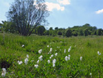 Rough, wet grassland near the source of the River Yarty in the Blackdown Hills, with many unusual plant species Rating: ★★★★★ |