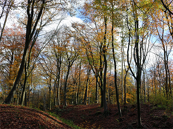
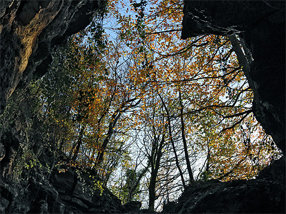
Ancient ash and beech woodland on steeply sloping ground above the River Avon, plus several old quarries, now colonised by calcareous grassland scrub and wildflowers
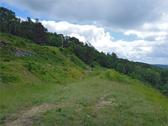
Browne's Folly Nature Reserve, also a Site of Special Scientific Interest, covers 100 acres of steep, west-facing slopes above the River Avon, 3 miles east of Bath and just south of Bathford village, containing a mix of ancient and more recent woodland plus a sizeable patch of calcareous grassland which has colonised the largest of a number of old quarries and stone mines scattered across the site. The folly itself, a square-based stone tower built by local quarryman Wade Browne in 1848, is just outside the reserve, on the brink of the high ground to the east.
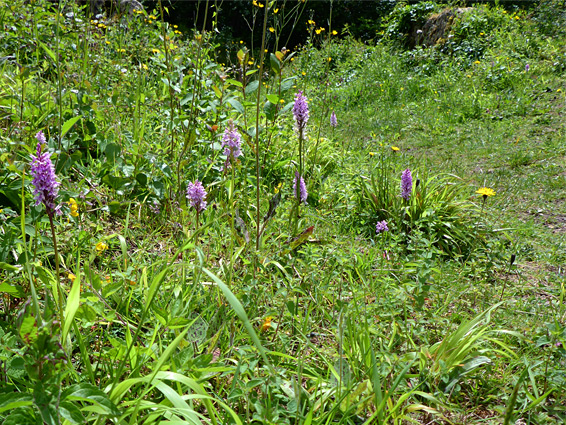
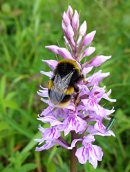
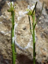
The nature reserve is relatively large, nearly one mile north to south, and is crossed by various paths and tracks on different levels of the slope. The ancient woodland occupies the lower elevations, and here are found several rare plant species including spiked star-of-bethlehem (Bath asparagus), bird's nest orchid and white helleborine, but most wildflowers occur on the main quarry site, where grass and scrub is kept in check by regular cutting, allowing a good range of species to flourish, including various orchids, rarest the fly and musk species. The old mines are home to six species of bat including the rare greater horseshoe bat, and the reserve is also noted for its butterflies and fungi.
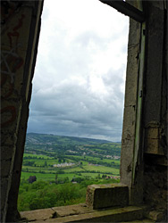
A walk can take several hours if exploring all areas, and the woods are photogenic any time from the spring blooming of April to the autumnal colours in September and October. Although large and scenic, offering fine views over the Avon valley and the hills around Bath, the place is not often visited, partly as it is not obviously signposted and reached only by a steep, narrow lane.
The main entrance to Browne's Folly Nature Reserve is at its northeast corner, along the road between Monkton Farley and Bathford - Prospect Place in the north, Farleigh Rise further south. The parking area is on the site of one of the old quarries; others are scattered most of the way across the upper woods, but by far the largest is just below the folly tower, and of this about half is clear of trees, occupied by the calcareous grassland, while the southern half is densely wooded. A narrow band of trees all across the uppermost slopes, containing the folly, is outside the reserve, all part of Farleigh Down Plantation, established in the early 19th century. To the west are the slopes of Bathford Hill, originally all scrub and rough grassland, later excavated for the quarries, all of which are now wooded apart from the cleared, grassy area. Below here is the ancient woodland, once five separate areas (Sharp Leaze Wood, Rowbarrow Wood, Woodman's Breach, Prigley and Mountain Wood), now merged into one. The trees are mostly ash, plus wych elm, field maple and common whitebeam.
From the parking place, the main path heads west, close to several overgrown excavations, at least one of which contains a sealed adit, then turns south, leading to the upper north corner of the grassland. Another path crosses this at a lower level, and the connecting route leads uphill a little way, through the reserve boundary fence to the base of the folly, which is currently in a rather unstable condition, though seemingly still open to visitors. The viewing area at the top is accessed by a narrow staircase along the inside of the walls, completely lacking any railings, while the upper floor is also largely missing. A wider track runs just below the grassland, and other paths link to the one main and several lesser routes lower down. One of these crosses a short section of the ancient Wansdyke, running west-east through Rowbarrow Wood.